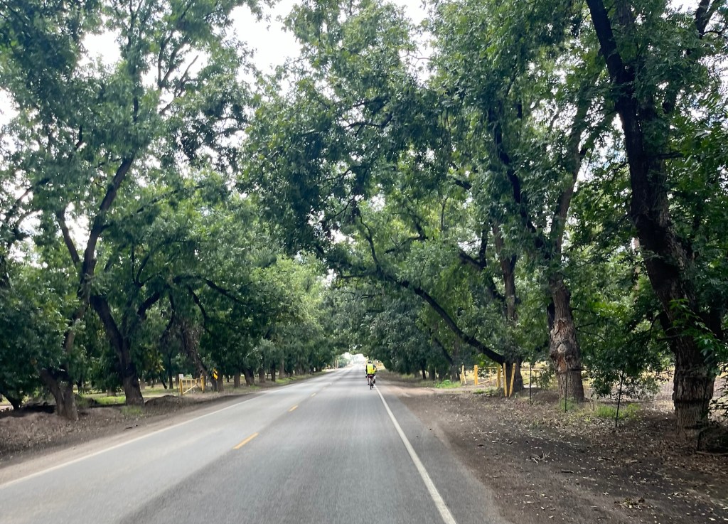
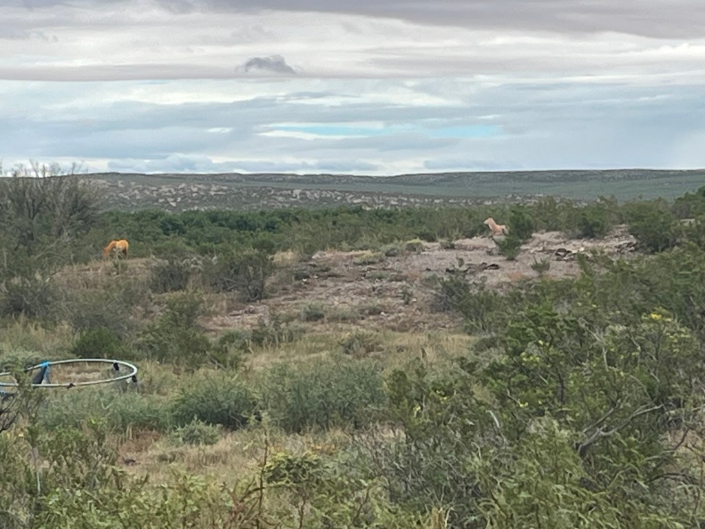
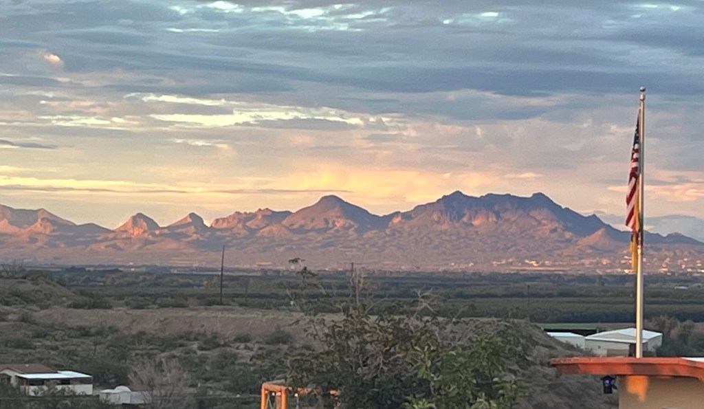
Today we had a nice ride from Las Cruces, NM to El Paso, TX through the Mesilla Valley. We traveled by Stahmanns Pecan Farm, the largest in New Mexico, with over 168,000 pecan trees and has been in business since 1932.
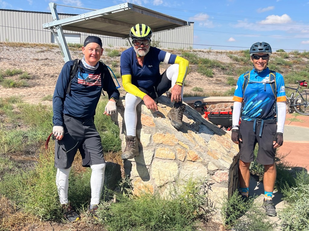
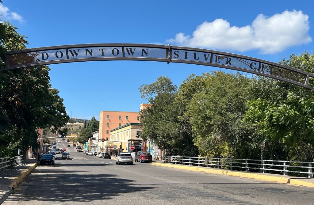
We rode about 7 miles down a bike path next to the Rio Grande where we entered Texas. Three states completed! We will now be in Texas for the next 3 weeks, longer than our entire trip so far.
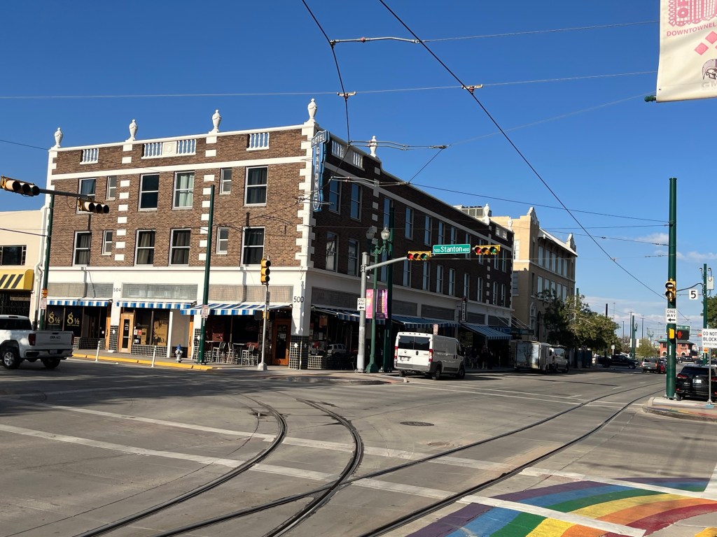
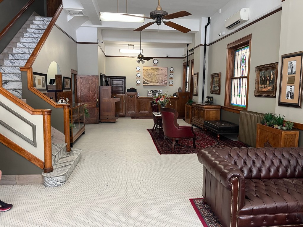
We are staying the night at a hostel in El Paso. The place has a lot of history. It started as the Gardner Hotel in 1922. The third-generation owner, Joe Nebhan, met with us tonight and told stories about the hotel including that John Dillinger stayed at the hotel and that Pulitzer Prize winning author, Cormac McCarthy, wrote several of his books while residing at the hotel. Joe turned the hotel into a hostel in 1984 and continues today in that format, being managed by his daughter.
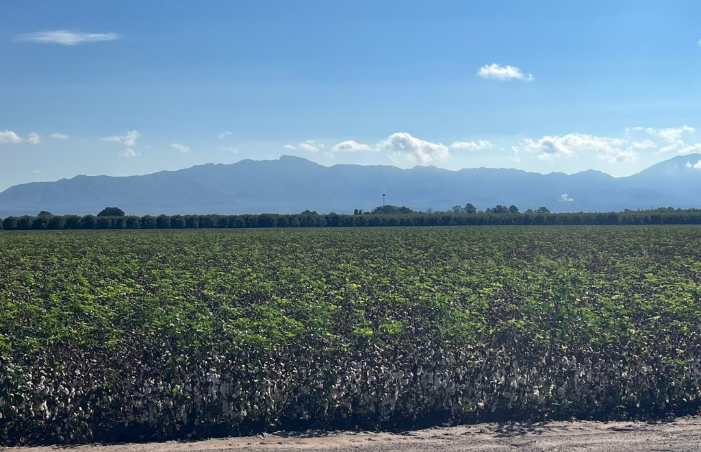
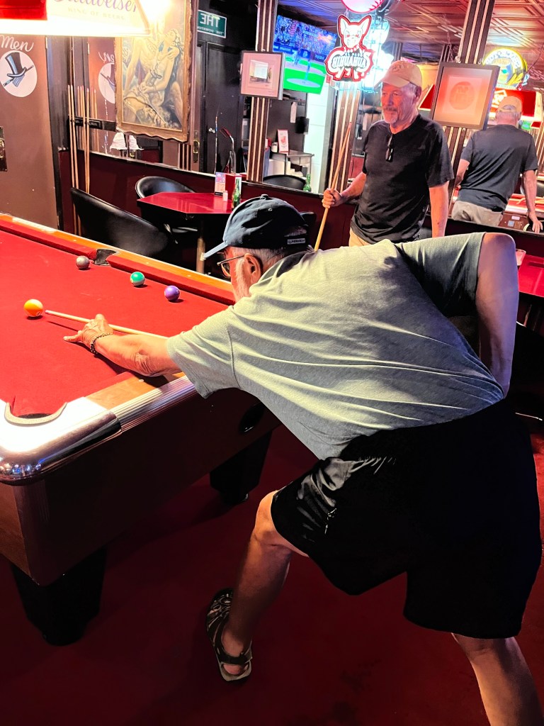
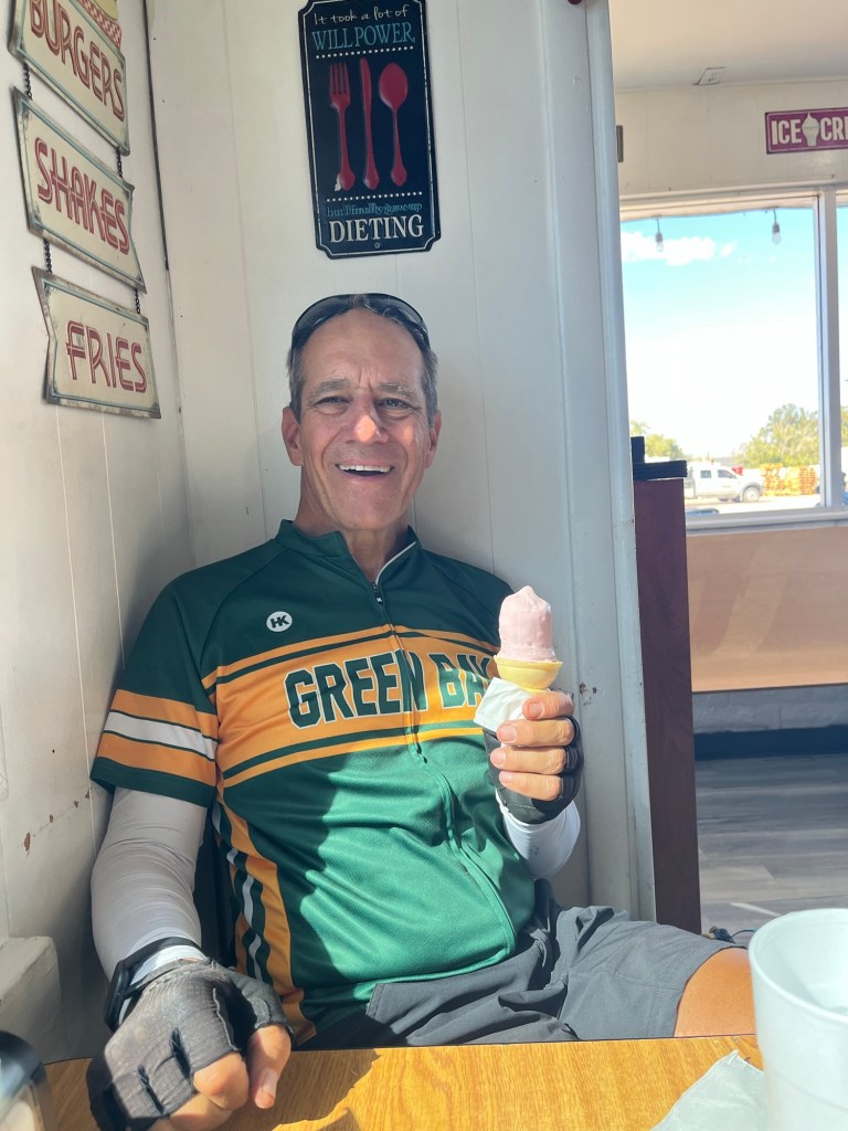
Trees from Stahmann’s pecan farm created a canopy over the highway. Pat and Brent are riding ahead. Cotton fields, followed by Pecan trees, and the mountains in the background. Chris, Pat, Tom, and Brent (taking photo) at the point on the bike path we believe we entered Texas. The sign on the stone marker had been removed. For my cat-lovers (Nancy, Jeff, Sue), this mural is in downtown El Paso near our hostel. It is made out of a lot of recycled junk. Can you find the bicycle? And I later found out it is a mountain lion. The hostel at the Gardner HotelThe lobby of the Gardner HotelWe ate dinner at “The Tap” in downtown El Paso which has been in business since 1956. We played a few games of pool with Tom and Pat taking the victory over Dana and Felix. Here Pat is lining up his shot with Dana watching.
Today’s ride followed the Rio Grande valley from Caballo Lake to Las Cruces. It was a gradual downhill ride. We had a headwind but not as bad as other days. For the first half of the ride, there was only one light drizzle, but the second half of the ride had a steady rain. There was also a section where farm implements dragged a lot of mud on the road and my bike and I got full of mud. I had to clean it up when I got to camp. The good thing is that the rain stopped when I got to camp.
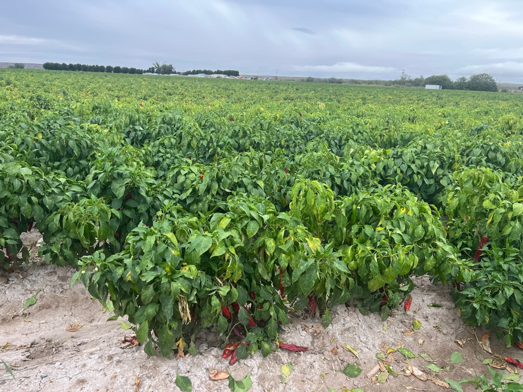
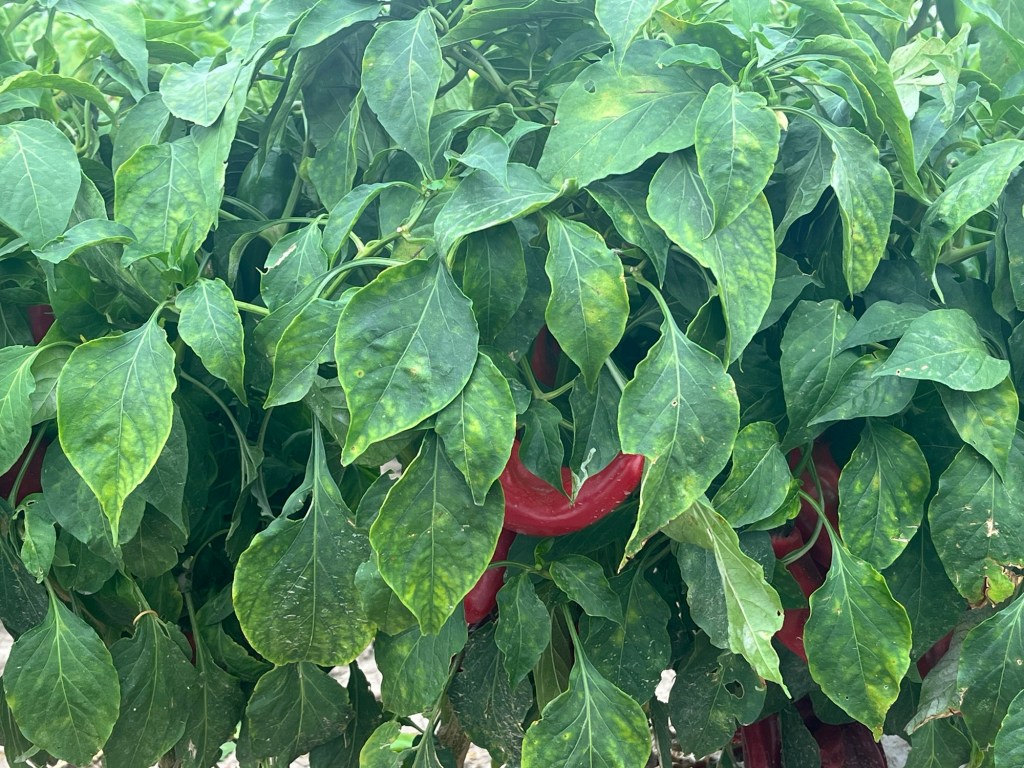
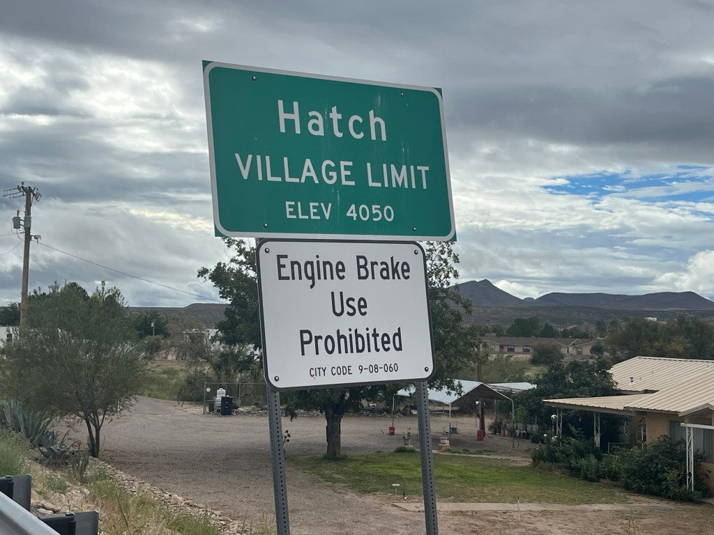
We rode through the village of Hatch, New Mexico which is known for their Hatch chiles. There were fields of chile plants and processing factories all around Hatch. When riding by the processing plants, I got really good scents of chiles. In New Mexico cuisine, there are abundant uses of both red and green chiles and chile sauces. The chiles are generally not too hot, and the green chiles are generally milder than the red. Sometimes you’ll see “Hatch chiles” on menus in the area. Hatch is a cool little village where everything revolves around the Hatch chiles.
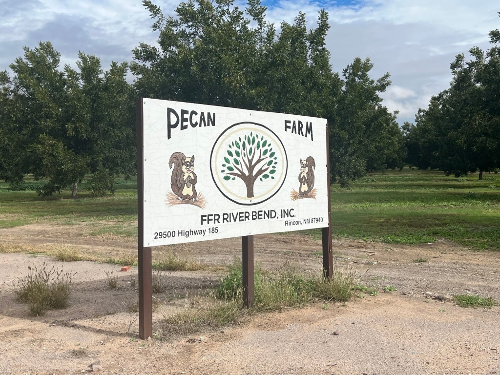
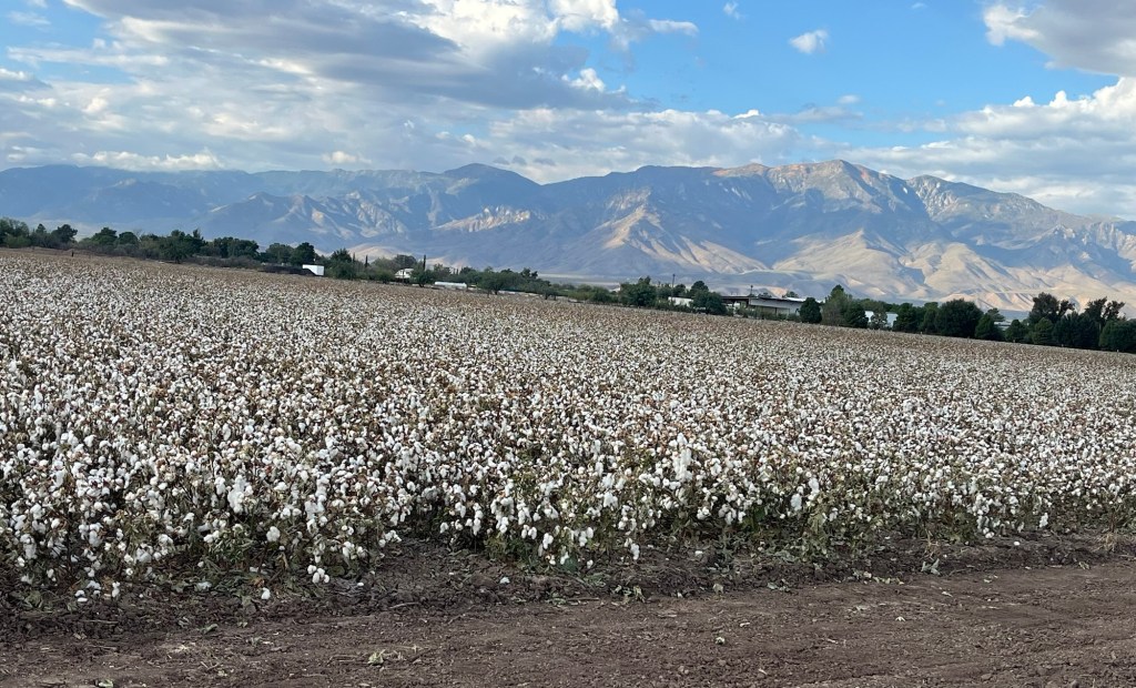
After Hatch, I rode past many Pecan farms with rows and rows of pecan trees.
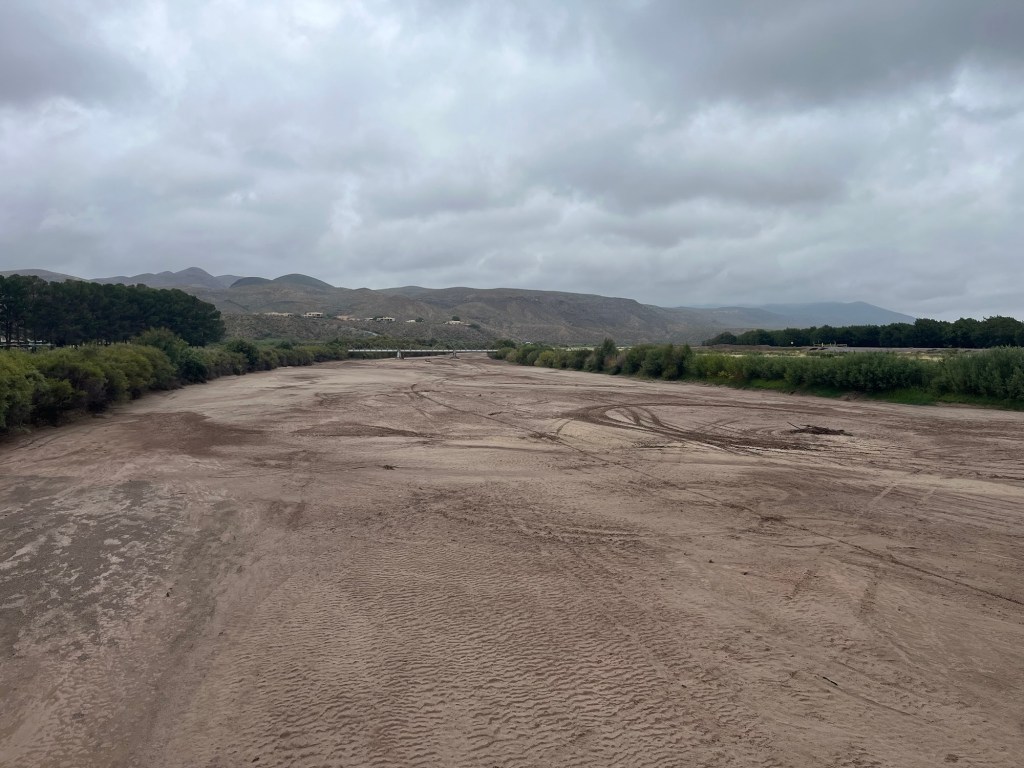
We also crossed the Rio Grande three times and there was little water in the river.
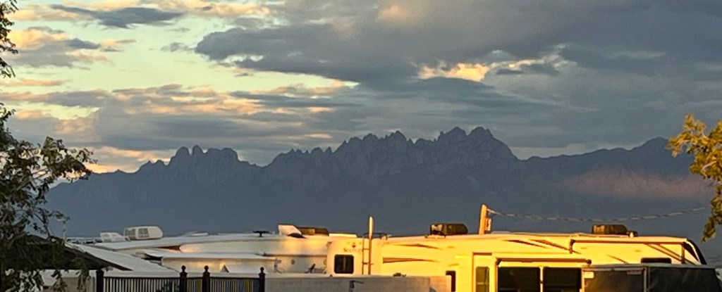
Tonight we’re camping at the Las Cruces KOA and it is by far the best campground we’ve stayed at. While I’m writing this, I’m sitting by a fire pit enjoying a beautiful New Mexico evening.
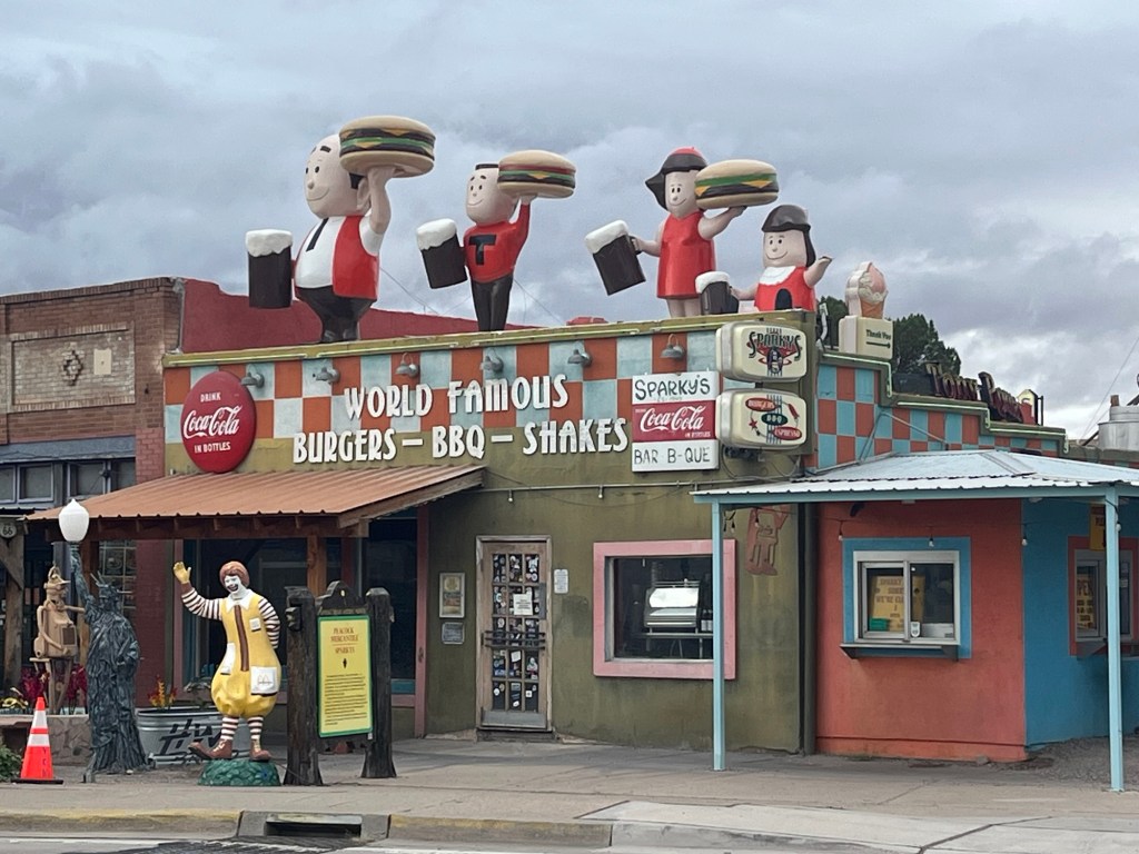
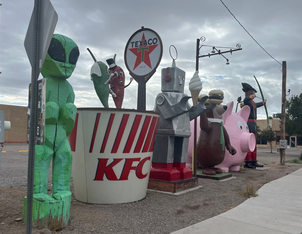
Fields of chile pepper plants near Hatch. Close up of chile plants Entering Hatch, New MexicoWorld Famous Sparky’s in Hatch was not open when I rode by. Across the street from Sparky’sMore fun in HatchWhen I first saw these groves of trees, I wasn’t sure what they were. Then I found this sign. Pecans!I saw two animals in the distance. Still don’t know what it was. There were some cool rock formations along the way but the cloudy skies didn’t show off the red colors. If you look closely, you’ll see dirt and mud all over my backpack and bike. It was worse than what the picture shows. This is the Rio Grande from a bridge I was on. I didn’t see any water at this crossing!!!A view from our campground of the Organ Pipe mountains. Another view from our campground One more of the sunset sky.
Today’s ride was only scheduled for 23 miles, and is the shortest riding day of the entire adventure. I’m not sure why they scheduled it this way, but it felt like another rest day for most of us.
We had camped at the Hillsboro Community Park and we voted it the second worst campground so far, mainly because there was only one shower in a shack a couple blocks from our campsite, and there were only pit toilets. Also, the only way to get cellular service was to walk to the highest point in the town and you might get Verizon service only. We had WiFi but we had to walk across the street and sit by the local museum to get a signal.
Instead of riding out early, we decided to eat breakfast at the Hillsboro Cafe. My omelette with green chiles was awesome and the service was great. So at least the town had that going for it.
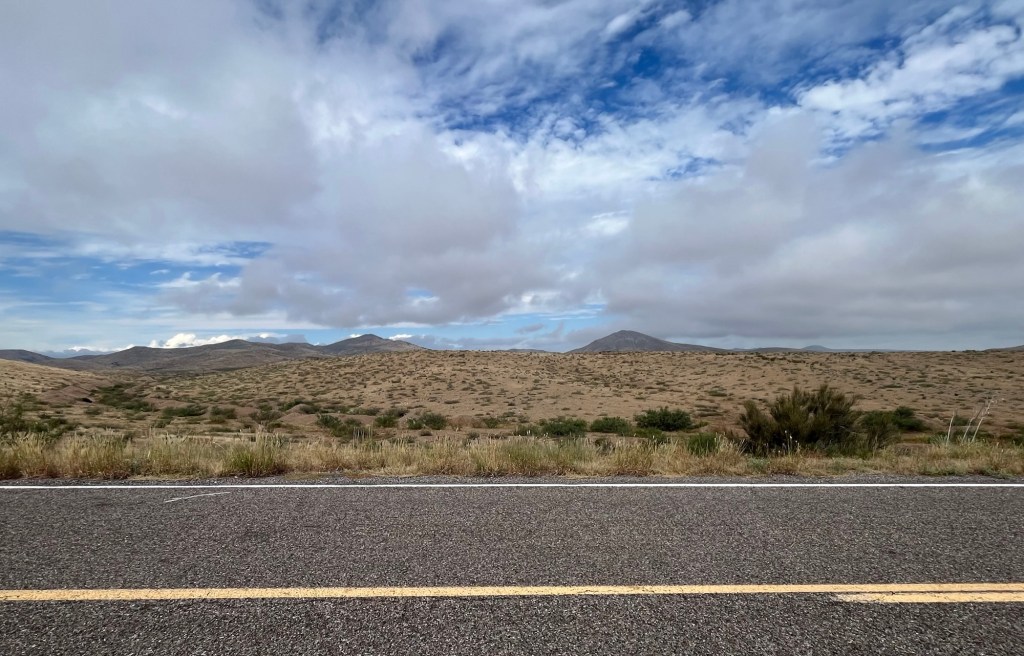
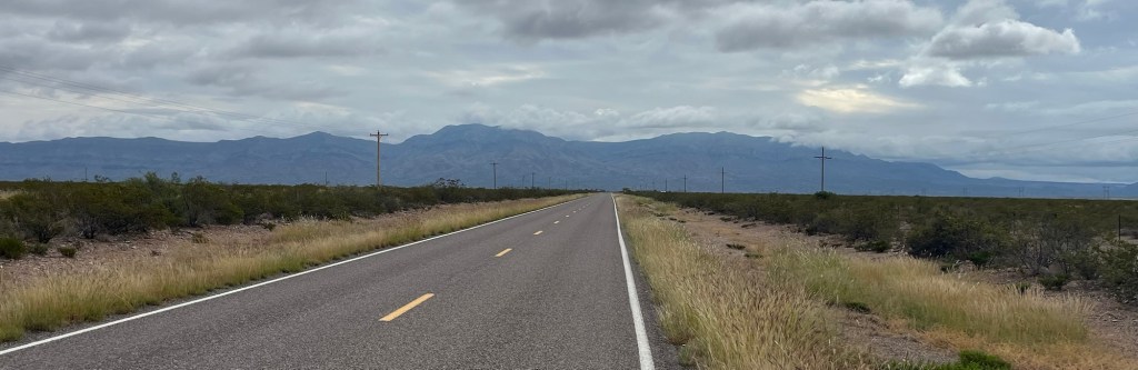
The ride itself was mostly downhill through a desolate part of New Mexico but we had a beautiful view of the Caballo mountain range in front of us for most of the ride.
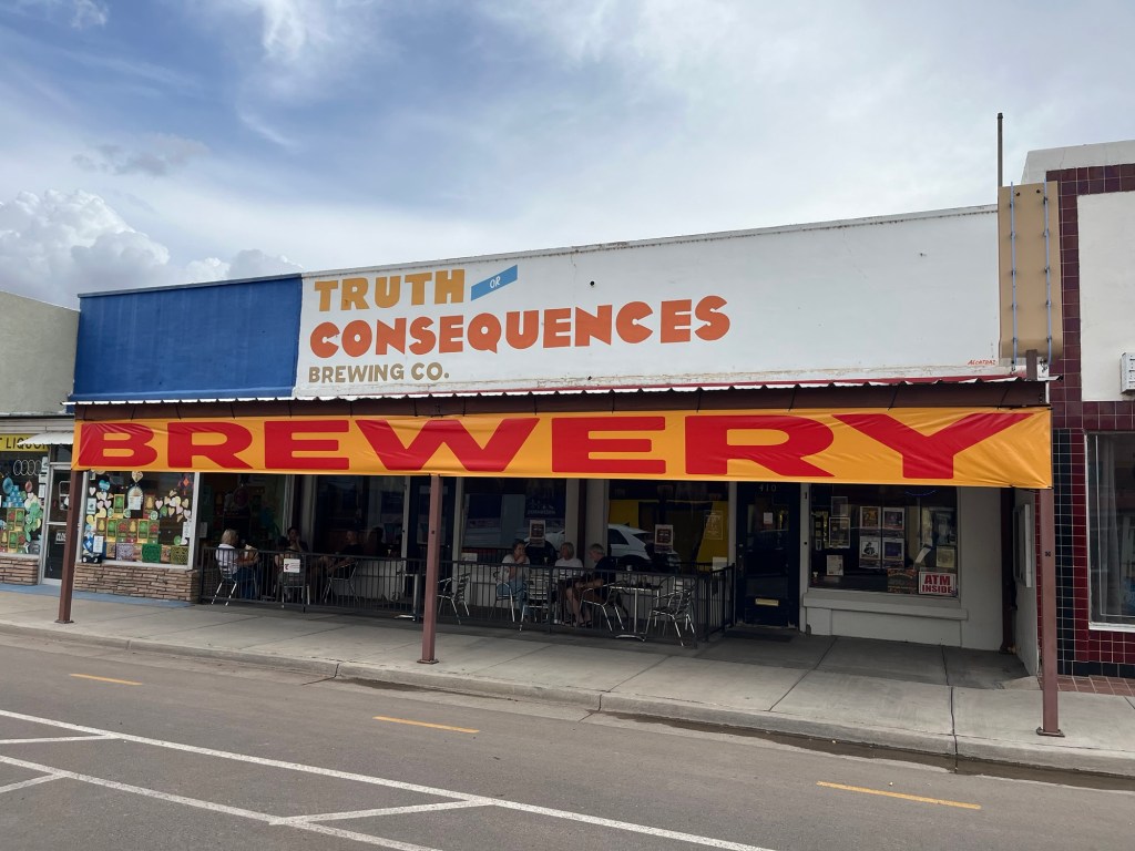
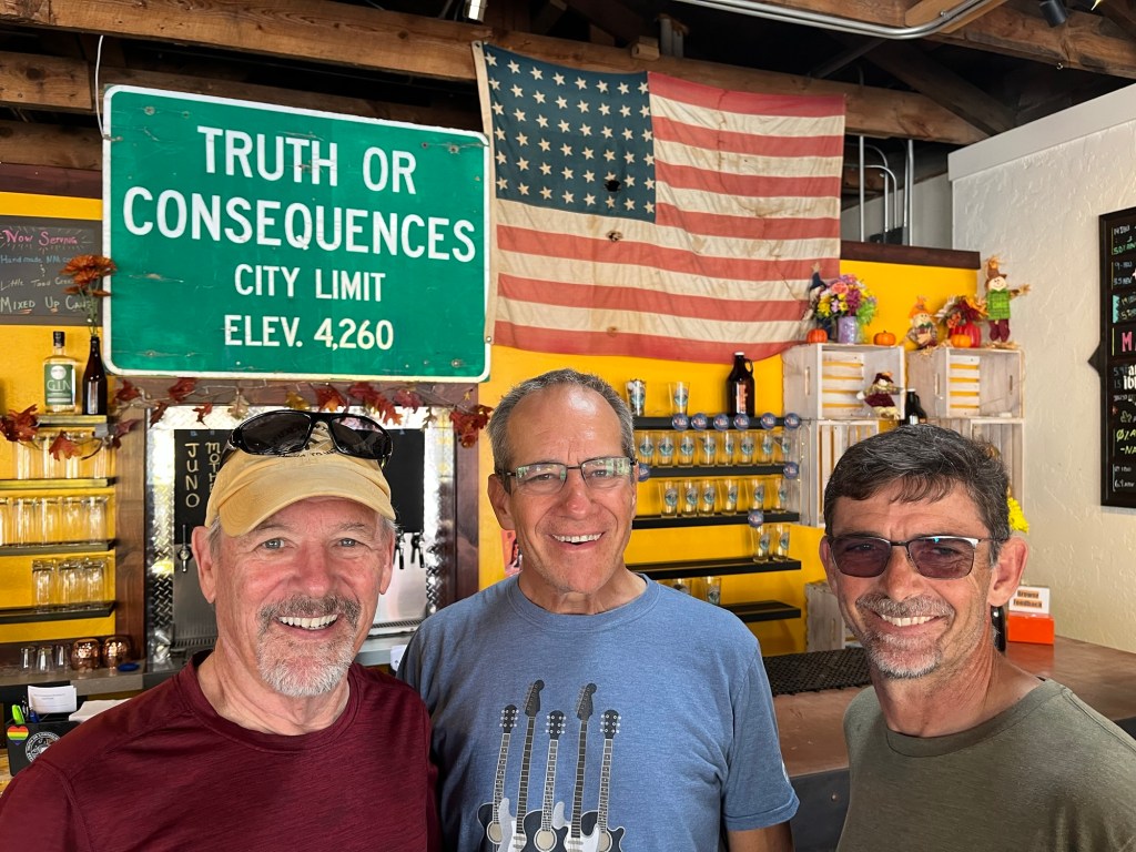
We arrived at our new campsite in Caballo Lake State Park and had a lot of time on our hands. So we all jumped in the van and took a ride to Truth or Consequences. I always wanted to go there not because there was much to see, but because it had a cool name. Truth or Consequences was originally called Hot Springs, New Mexico but changed its name to Truth or Consequences after the game show in 1950 as a publicity stunt, and the name stuck.
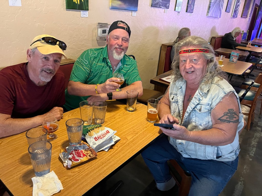
Felix, Dana, and I ended up at the Truth or Consequences brewery. Who would have guessed? They had a Green Chile Amber beer on draft that was quite good.
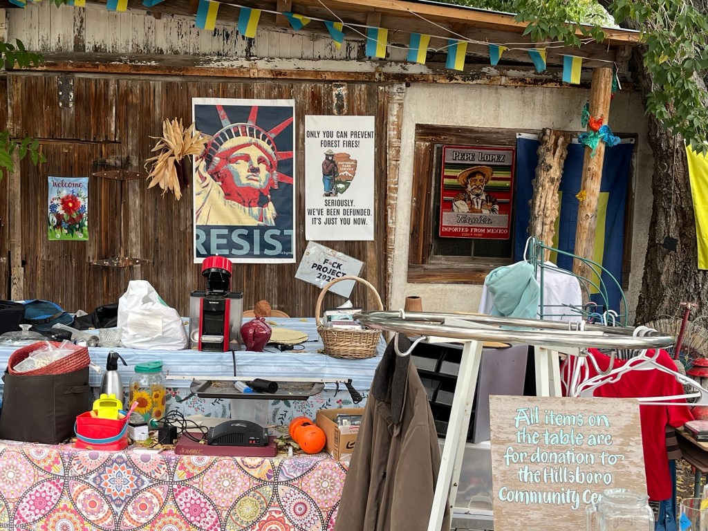
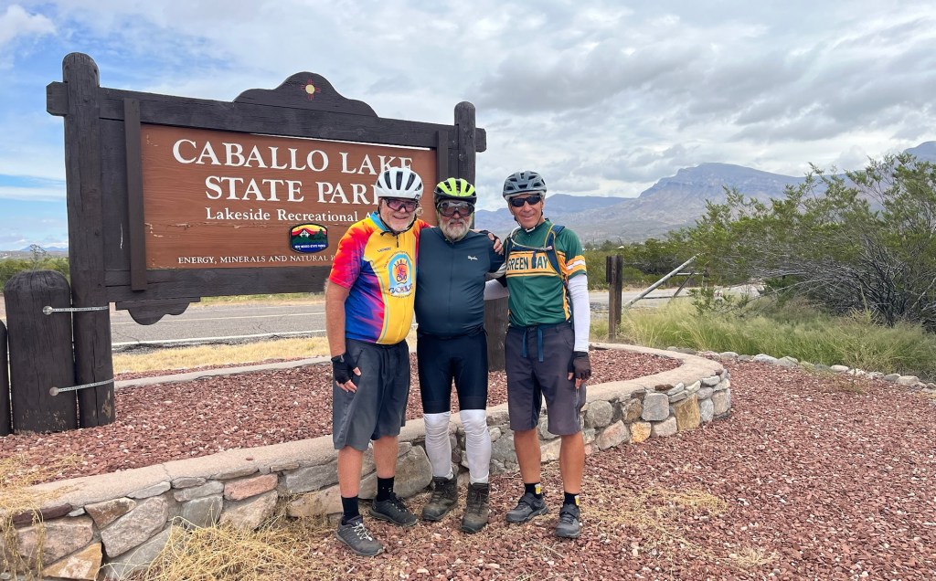
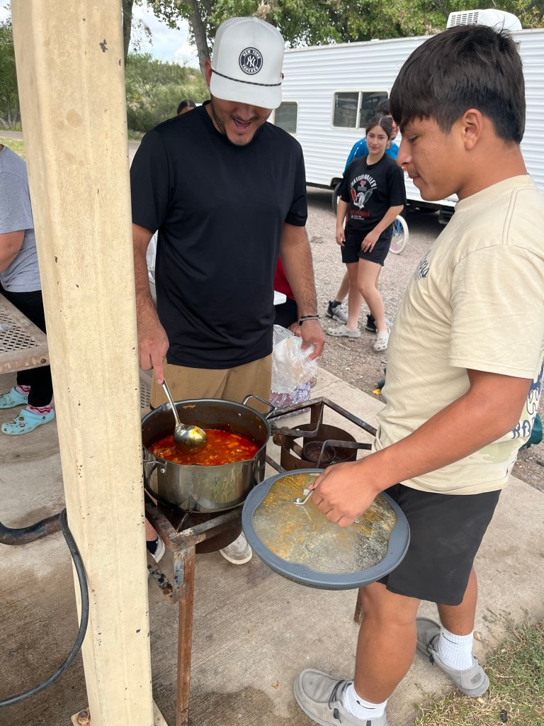
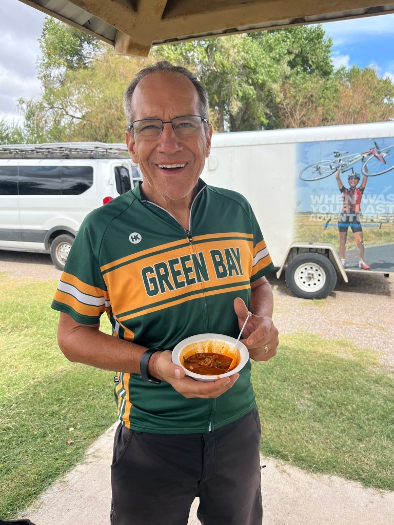
There was an eclectic “store” next to our campground in Hillsboro. I laughed at the smoky the bear sign. We rode through vast open lands in New Mexico today, and I was happy to see some blue skies this morning. Even though we seemed to be in desolate areas, there are always signs of humanity. This morning silhouette of the Caballo mountain range was our view for most of today’s ride. Note: our route turns right before the mountains!For Margaret and my Phoenix friends, we see these injury lawyer billboards all the time, and they’re also in the middle of nowhere, New Mexico!Roy, Pat, Tom, and Chris (taking photo) arrive at our new campsite. Soon after we arrived at our campsite, Miguel, on left, walked over and asked if we wanted some extra Posole. Here he was warming it up for us. I never had Posole before and it was delicious!!! Oh yeah, the Packers won today!Hanging out in Truth or Consequences. Dana, Tom, and Dale. Dana, Felix, and Joe who randomly asked if he could sit with us and proceeded to tell us about his motorcycles
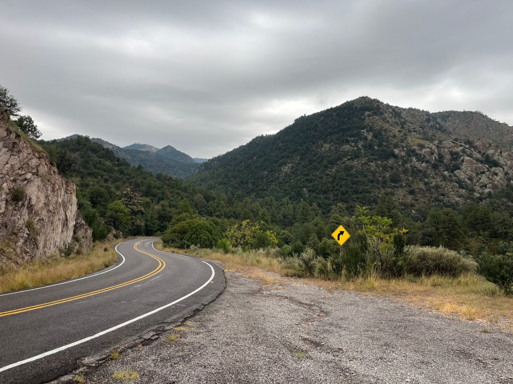
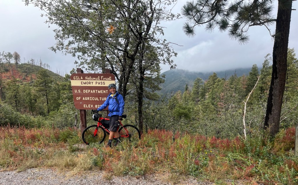
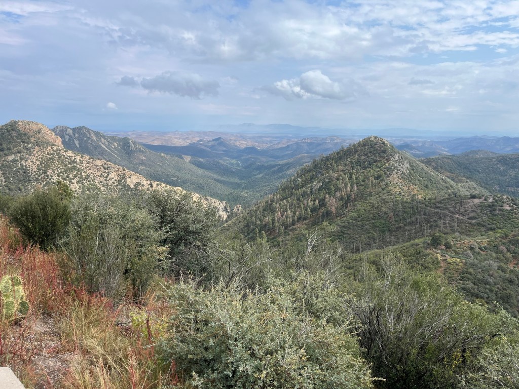
Today’s ride took us from Silver City over Emory Pass and then to the little town of Hillsboro, New Mexico. Another challenging ride to get to the top of Emory Pass with 4,422 total feet of elevation gain.
We started the morning with a map meeting for the route and a rainbow appeared. You know a rainbow needs sun and rain. Guess what? The rain prevailed. It rained almost all of today’s ride, from a drizzle to a steady rain, to a downpour, but no thunderstorm thank goodness. I was expecting some rainy day rides during this adventure and we got one today.
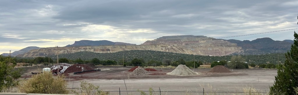
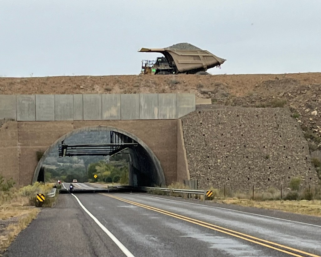
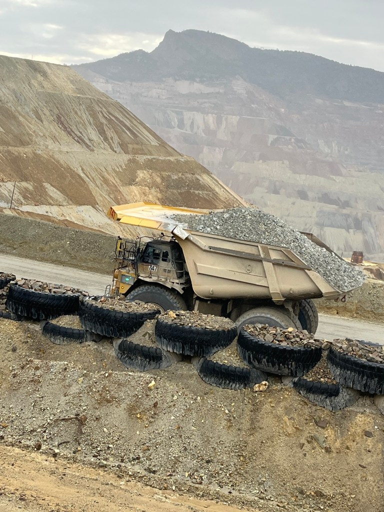
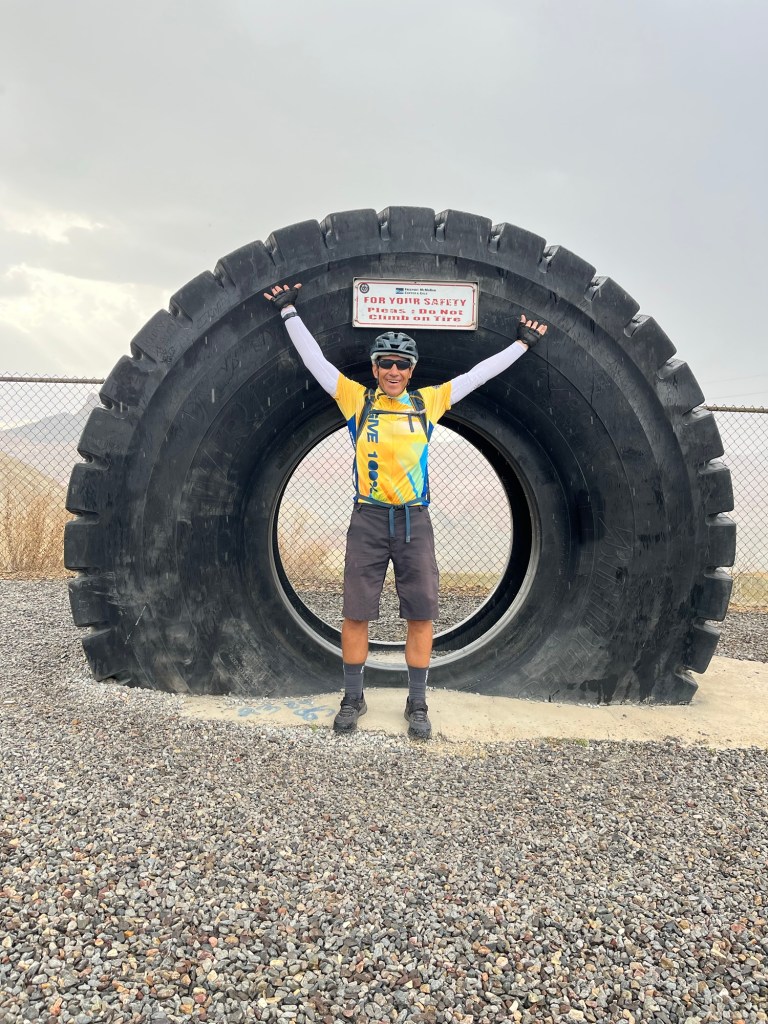
We started the ride going past the Chino Mine (also known as the Santa Rita mine) which is the largest copper mine in New Mexico. We saw the giant dump trucks hauling rock at the mine.
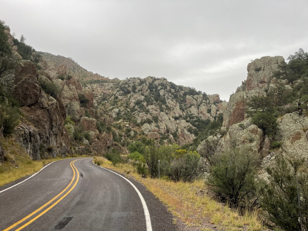
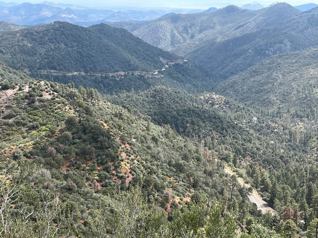
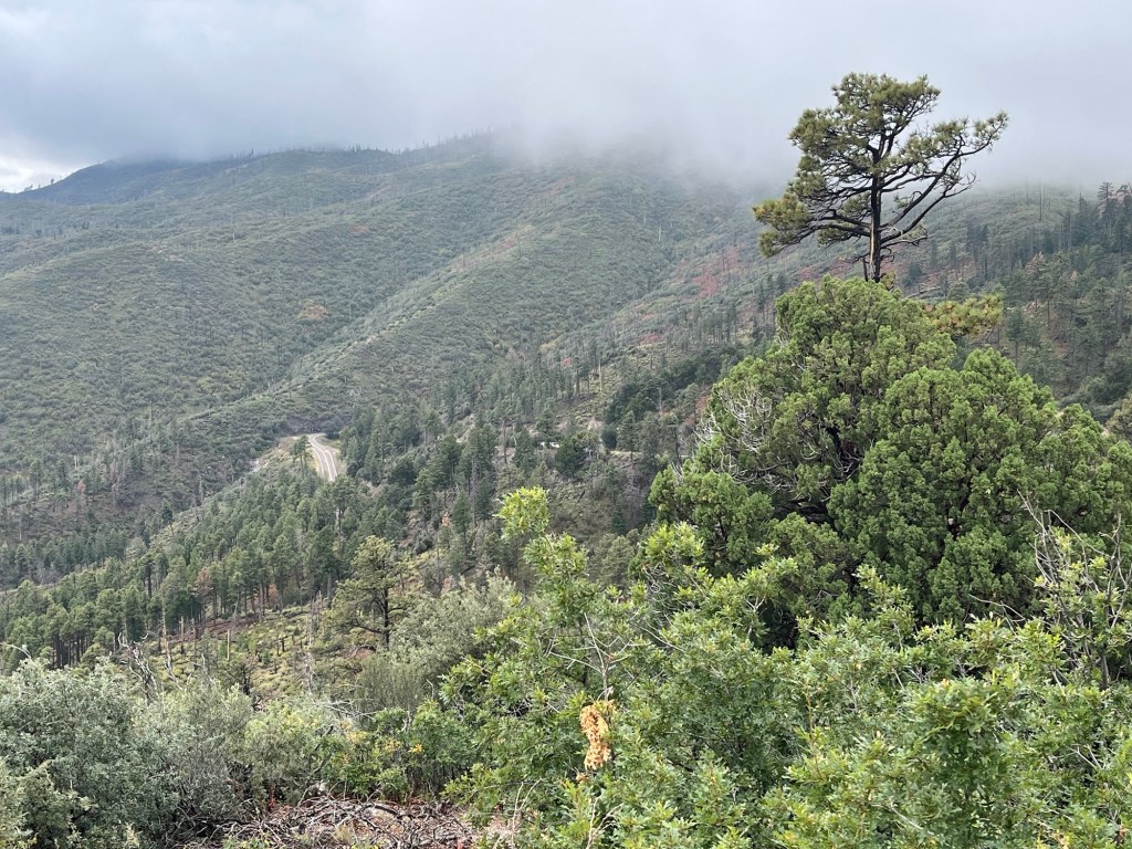
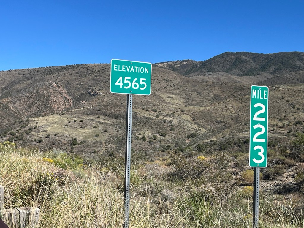
Then we started the climb to the top of Emory Pass. It took me about 4 and a half hours to get to the top. At over 8,000 feet, it was one of the days I was looking forward to. A challenging ride but worth every minute (including the rain). This is the highest point we’re going to reach and it’s all downhill from here, or so they say.
At the vista point of the pass, we had amazing views. A man drove up in a van and started looking at the mountain sides with his binoculars. I asked him if he was looking for animals and he said black bears. It is bear hunting season and he said there had been some sightings earlier in the day, but he saw nothing while we were there.
After we left Emory Pass, we had a 15 mile downhill ride to Hillsboro, New Mexico. It’s usually fun to go downhill, but in cold rain it’s a different story. The worst part was my fingers were freezing on the downhill. I brought winter riding gloves for days like this, but they were in the trailer (oops!).
Everyone on the tour agreed this was the best ride of the tour so far.
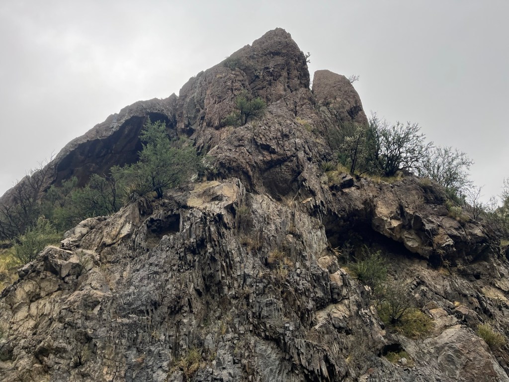
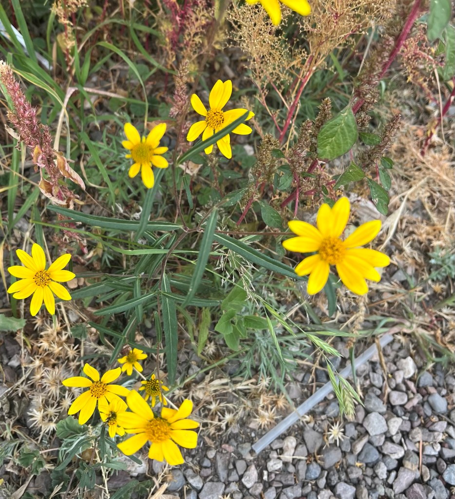
The Chino copper mineMine dump truck with Dana and Felix coming through the tunnel. The large trucks hauling rock came right past our viewing point. Big tires!!!Starting the climb toward Emory Pass. Should I be worried? We had no snow or hail, only cold rain. Getting higher up I could smell the pine trees. Continuing to head up the winding road. Some cool rock formations heading up toward Emory Pass. Looking up from the road. I made it to 8,228 feet. More proof I made it!!!View from top of Emory PassMore views. Note road at bottom right and out in distance I would be descending shortly. More views. Note the clouds coming over the mountains that would soon be showering me on the way down. Wild flowers at the top of Emory Pass. I took a closeup because my sister-in-law Sue likes doing that (I didn’t notice the straw when I took the picture)!
I should first explain why I recorded 8.8 miles for yesterday’s ride. I rode only 1.5 miles before the flats, but after I picked up my bike today, I rode the 7.3 miles from the bike shop to the campground which is part of yesterday’s route. It was a good ride to test the new tires and adjustments. All good!
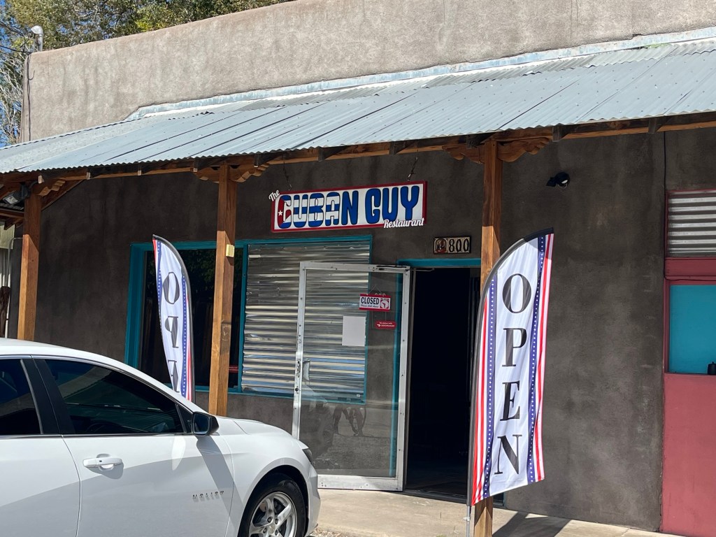
Today, several of us took the van to Silver City. Pat recommended “The Cuban Guy” for lunch. We had Cubano sandwiches which were awesome. After that I picked up my bike and rode back to camp as I mentioned.
I chilled out for a while and charged all my electronics which at times can be challenging at these campgrounds.
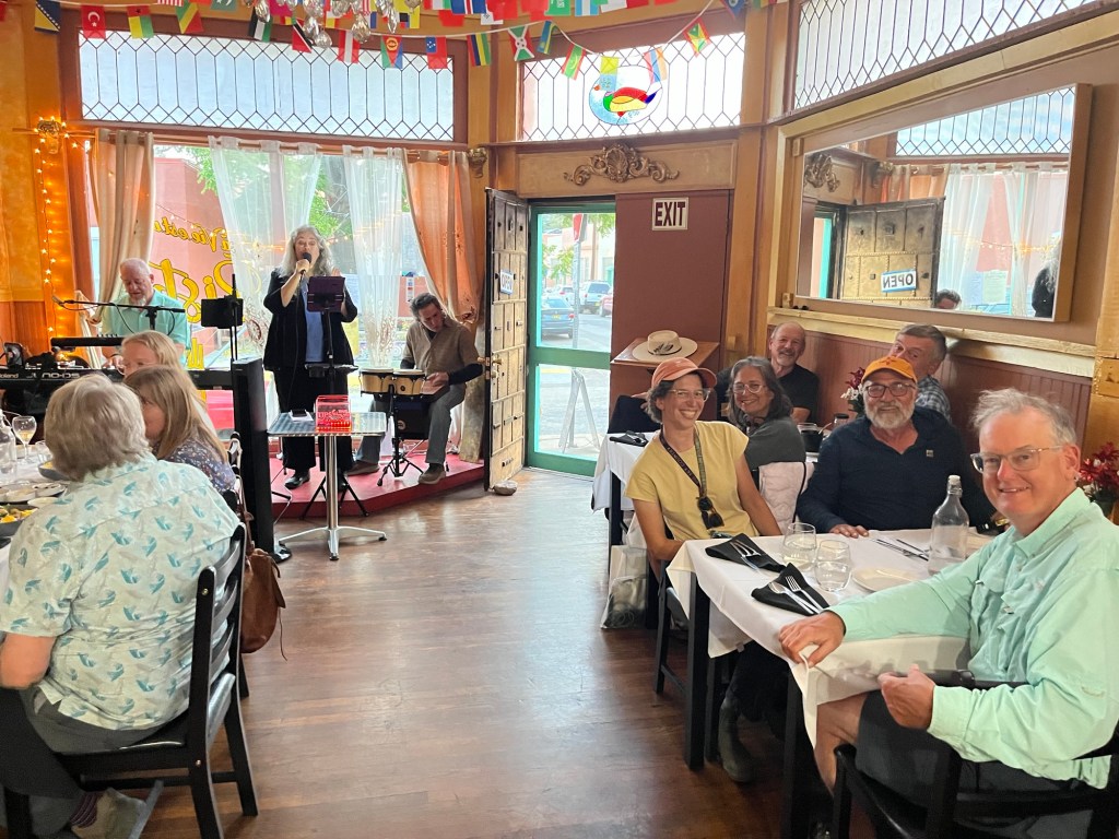
Eight of us went back to town and ate at a French restaurant in Silver City! The meal was quite good but the service was atrocious. We were there almost three hours. Time to go back to camp and sleep!
Silver City, New Mexico The Cuban Guy restaurant. It didn’t look like much from the outside, but the Cubano sandwich, black beans, and guava and cream cheese empanada were awesome.Simona, Tammy, Dana, Pat, Roy, Chris and Felix (oops I cut him off) at Le Vie Et Un Bistro with live music.
I’m calling this Bummer Day #1 because I’m sure there will be more bummer days to come. The ride today was a good one and a challenging one due to high winds again. The route was from Lordsburg to Silver City and then another 6 miles to the campgrounds. Along the way it crossed the Continental Divide. Unfortunately, I was not able to complete it.
Let’s start from the beginning. Overnight, we were surprised by a light rain for a few hours. At first, I didn’t realize what was making the noise on my tent, but quickly realized it was raining. The rain got a little stronger about the time to get up, but ended quickly after that and we were able to pack our gear after it stopped, although our tents had to be packed wet. A minor inconvenience.
Off to riding on a cloudy morning… Unfortunately, I got two flats within the first 1.5 miles. Without going into the details of what I should or should not have done differently, I realized I was not going to be able to fix it and resolved to get a ride in the van today knowing there was a bike shop in Silver City to help me.
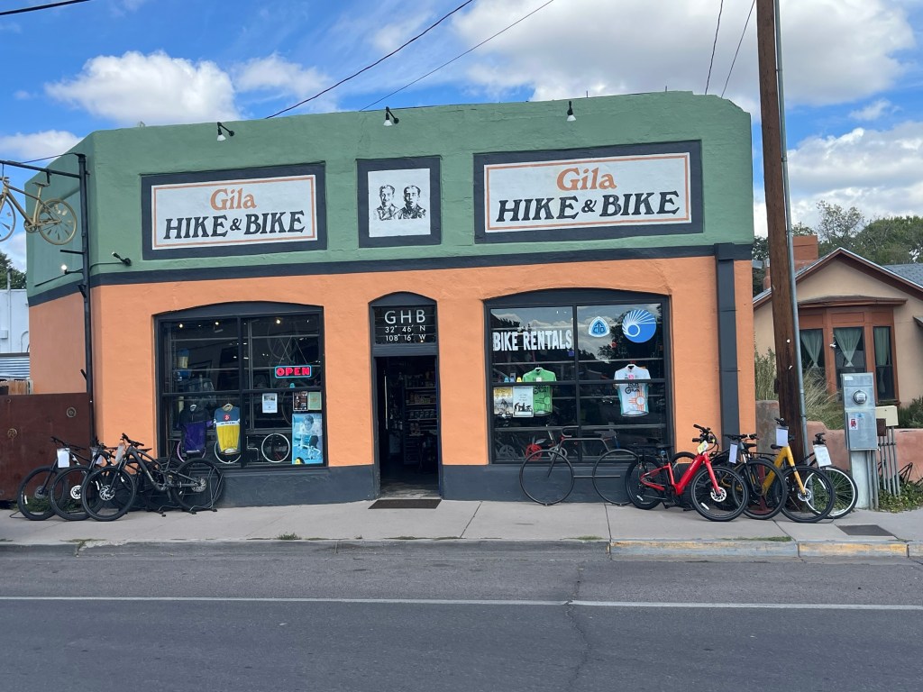
I was with Tammy and Simona and we set up a water break at the 28 mile mark. The rest of the riders came by at various times due to the uphill climb against strong headwinds for the first 18 miles. After all riders came through, we drove the van to the bike shop in Silver City. I got two stronger tubeless tires and some adjustments on my bike, and now I have more confidence in completing each day’s ride. Thank you Gila Hike and Bike!!!
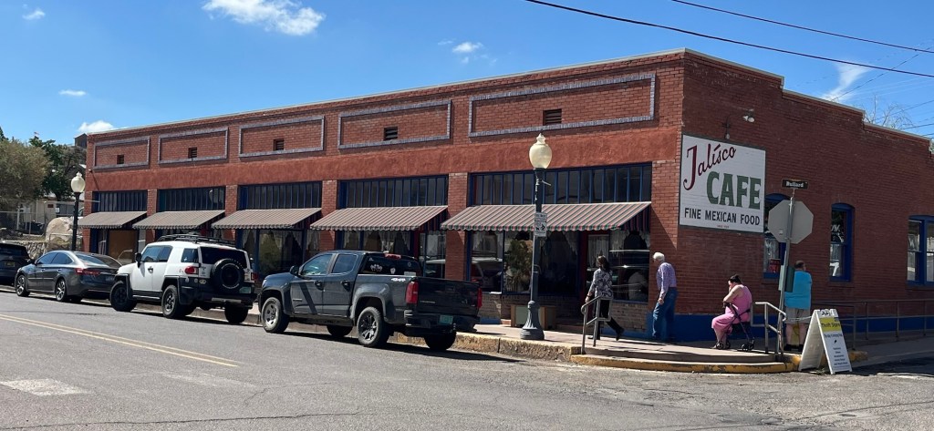
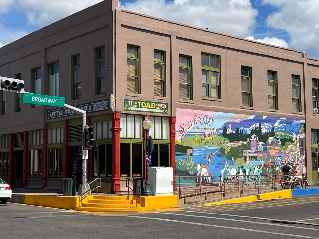
That night, we did a group dinner at the Jalisco Cafe for New Mexican food and it was great. Now was decision time. We could take the van back to camp about 6 miles away, or we could walk up the block to the Little Toad Creek brewery and find a way back to camp later. Dana, Felix, and I chose the brewery. It was Thursday night Music Bingo and the place was packed (and they didn’t give you the answers like at Pebble Creek). After three beers it was close to 10:00 and I called for an Uber. No drivers available. Felix tried Lyft with the same luck. We asked the bartender if they have uber service and he said there was one driver in town but he only works when he wants to, and tonight was not one of those nights! Now we had to scramble. The bartender told us to talk to the cop sitting with his wife at a near table. The young cop said he wouldn’t leave us stranded and first called the “drunk bus” that took inebriated people home, but then he realized it only was available Friday and Saturday. He agreed to drive us back to camp but he had a full large beer to drink, so we had one more. At closing time (11:00), we hopped in the back of the couple’s car and they drove us to the campground. Dana tipped him and so did I. They said it wasn’t necessary but we insisted. Disaster avoided!!!
In retrospect, that night was exactly what I needed to get me out of my funk from missing the ride today. To better days ahead.
Here’s our camp breakfast setup when it’s raining. Here’s my view of today’s ride…from the seat of the van with Tammy and Simona upfront. A welcome site to get my bike back in shape!Dinner at Jalisco Cafe. Over time they kept expanding to this entire building. And it was packed! A great place. The Little Toad Creek brewery. Just what I needed!!!
Today’s ride took us from Safford, AZ to Lordsburg, NM. It was a long ride with only one small town in between, Duncan, AZ. We generally went uphill as Lordsburg is at elevation 4,269 feet. This was one of the hardest rides since we started as I’ll explain below.
Let’s start with the rain. This was the first rain since the start of this trip and it was a non-event. The first 18 miles out of Stafford went relatively easy, then we got a little sprinkle from a pop-up monsoon storm. It only lasted about 5 minutes and was rather refreshing. But right after that came the winds.
It hit immediately and winds were in our face at 15-20 mph and lasted the entire 60+ miles of our ride. I was able to finish with 4 others, but the other 5 had to cut their rides short because it was so exhausting. It took me 9.5 hours to finish the ride today.
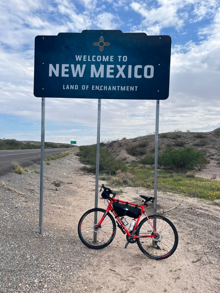
At about our 50th mile today, we entered New Mexico, the Land of Enchantment. We now have completed two states. Yay!
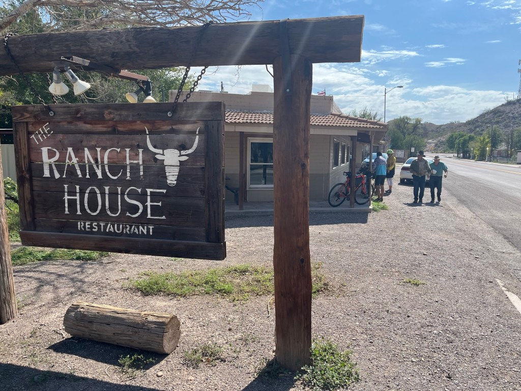
In Duncan AZ, I rode up to the Ranch House restaurant and there were 6 bikes on the porch. This was the place everyone was stopping for a quick lunch. I joined them and had a cheese crisp (tortilla with cheese). These fun random stops add to the adventure. We also learned that Sandra Day O’Conner grew up on the Lazy B ranch (which we rode by) near Duncan.
Other good news for the day. No flat tires!
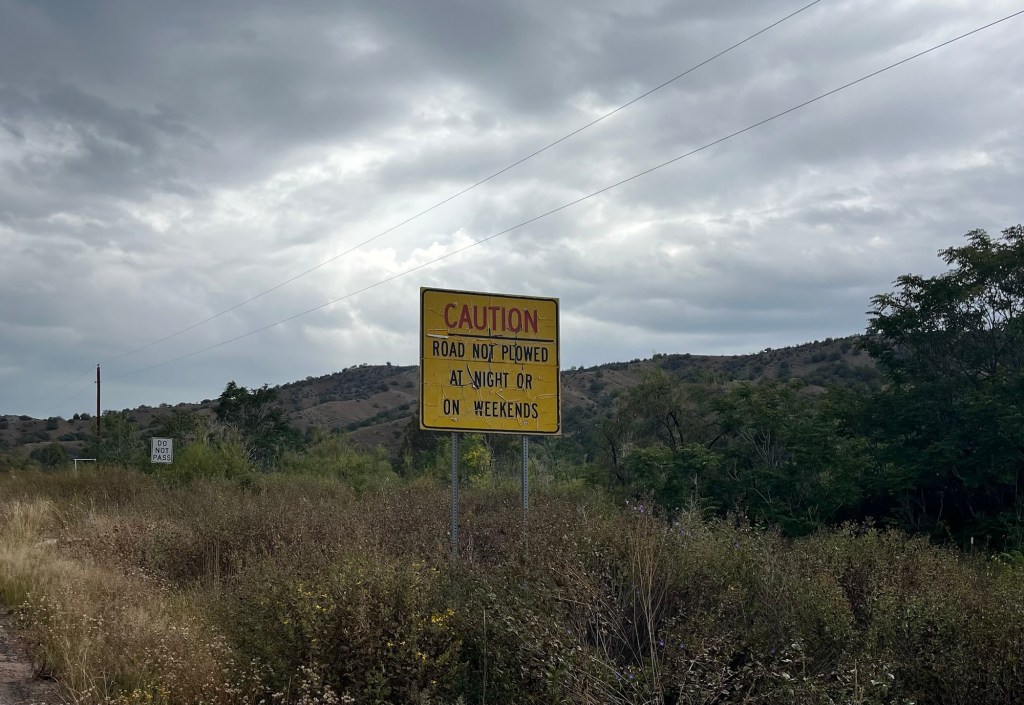
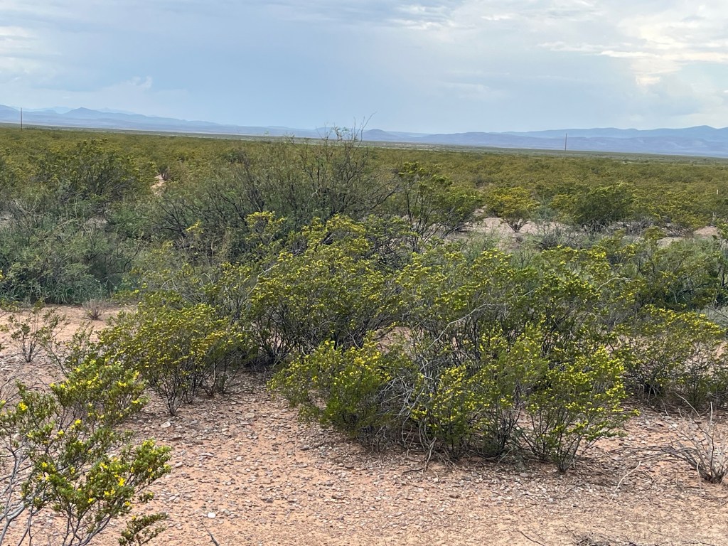
Cotton field with Mount Graham in the distance. Lunch at the Ranch House restaurant in Duncan, AZWe made it to New Mexico, our third state. Now at a higher elevation, there were these sagebrush plants everywhere with lots of yellow flowers. A makeshift water and snack break spot set up by our tour leaders. Margaret and I see these signs in New Mexico all the time when driving through. I had to take a picture for her. We always ask “why don’t they just fix it?”
Today we rode on Arizona Highway 70 from Cutter, AZ to Safford, AZ. This was my least favorite ride of the trip so far. Let me explain why.
The route itself was not too challenging with a big 6 mile descent near the beginning and then some gradual inclines over the rest of the route. However, there was about an 8 mph wind in our face the whole day. But the main reason was that Highway 70 didn’t have a great shoulder and we had to ride in the roadway until a car came and then ride into the shoulder. All day I was looking at traffic instead of the surrounding scenery, so I didn’t get many scenery pictures today. It was more stressful than the other days. And I also got a flat tire.
Remember when I told you I had good luck at the casino? Well that luck changed when I got back to my hotel room last night. My bike had a flat tire caused by a thorn and I spent the next hour fixing it. So this morning I was nervous about my tire. And I was right, at about the 23 mile mark today, I had another flat tire, this time due to a metal shard. Pat, Brent and Roy all helped with getting me going again. Luckily, I survived the rest of the trip with no more tire issues.
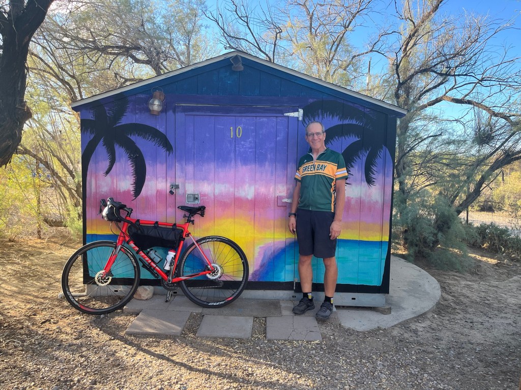
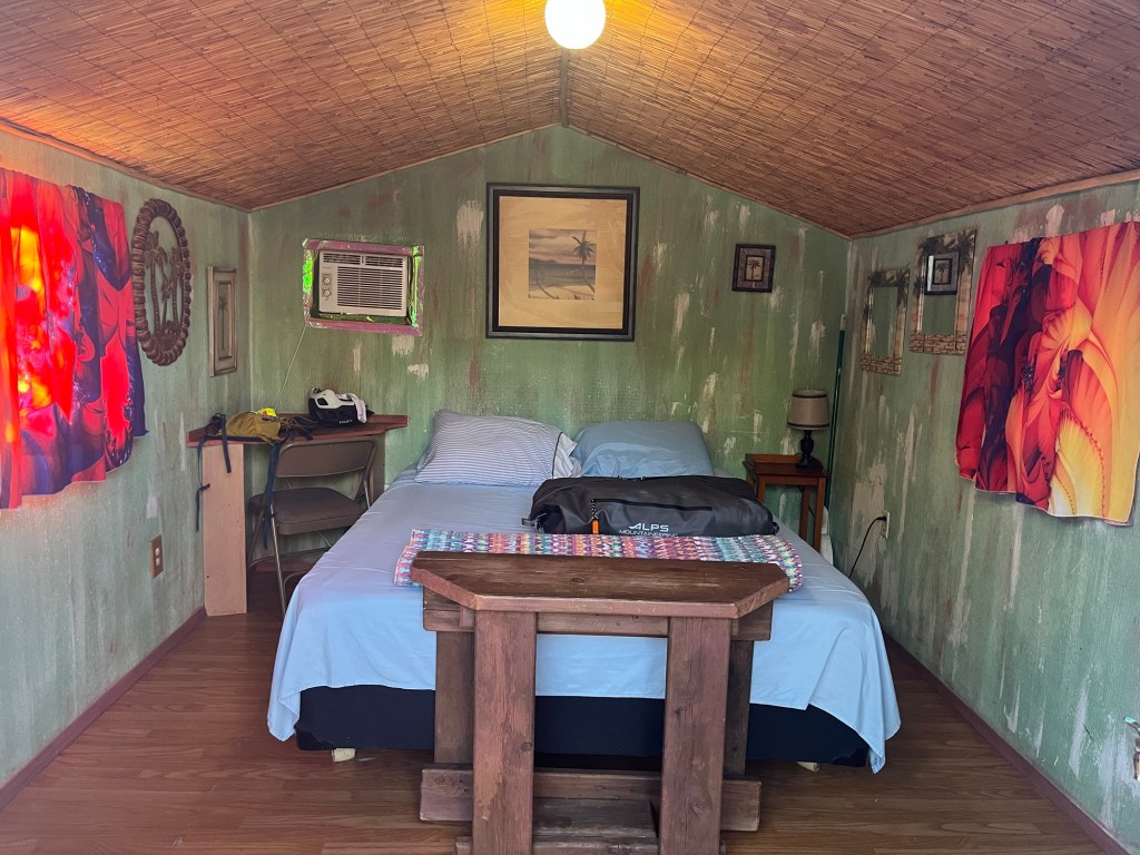
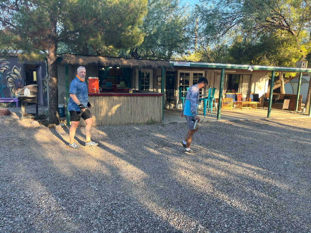
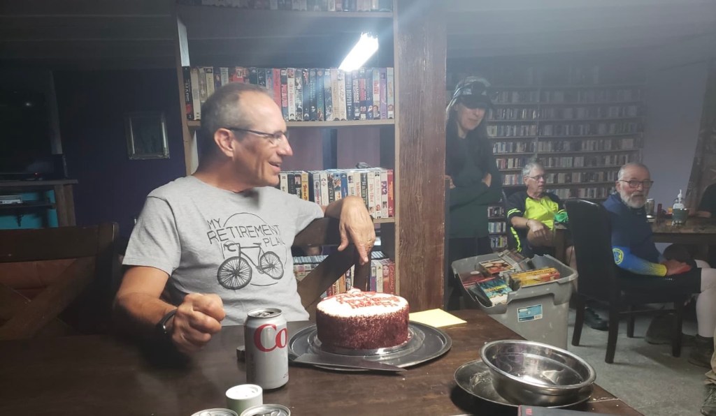
Now for some fun stuff. Today we are staying at “The Essence of Tranquility”, a hippie-looking place with natural hot springs. They have varied accommodations, and our group was assigned two single person cabins among other multi-person accommodations. I got one of the cabins because it is my birthday and Mark got the other as his birthday is tomorrow. Check out the pictures.
Finally, the group sang happy birthday to me and we shared a red velvet cake that said Happy Birthday Tom!
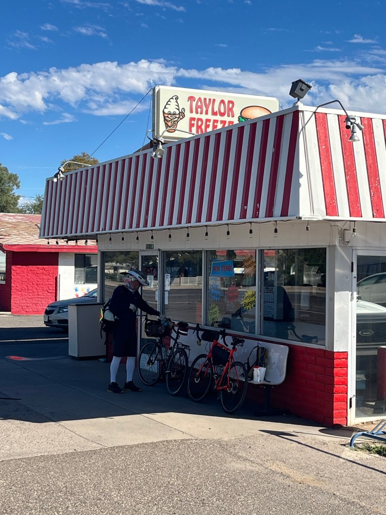
Looking back down the road we just came from. There’s nothing special about this town, except its cool name!We saw billboards for the Taylor Freeze for about 5 miles, so most of the bikers stopped here. I found Chris when I got here. Of course I had an ice cream. I had Black Raspberry which is one of their most popular flavors. I’m not showing this Diner, but look at the flag with the mountain backdrop. This indicates the wind we were riding straight into. My cabin at the Essence of Tranquility. And here’s the inside. Felix and Dale walking past the communal building where we cooked, ate, and had our map meeting. Celebrating my birthday with red velvet cake
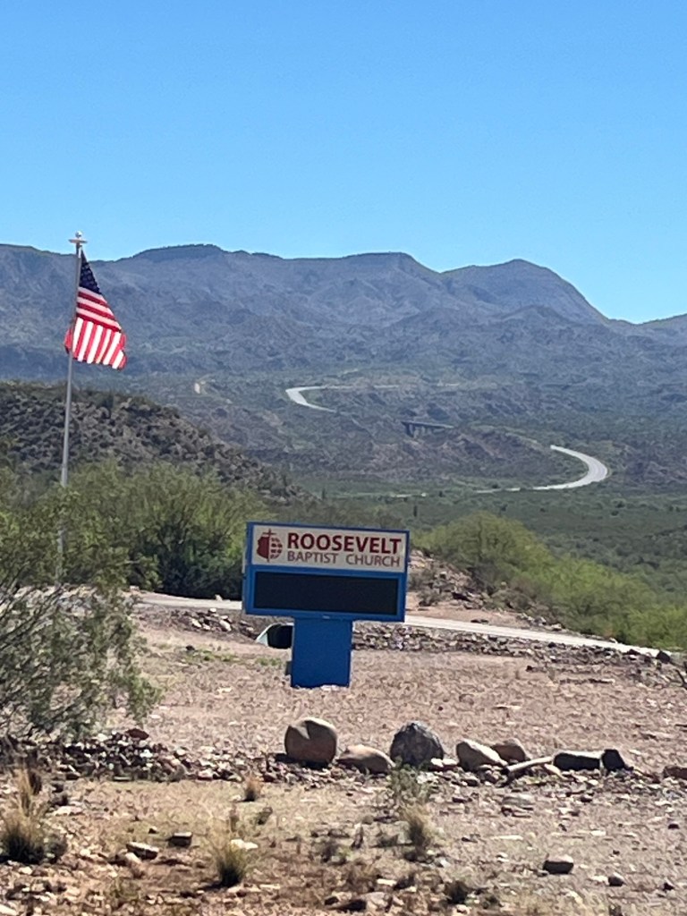
Today we rode from Tonto Basin through Globe and ended in Cutter, AZ (population 74).
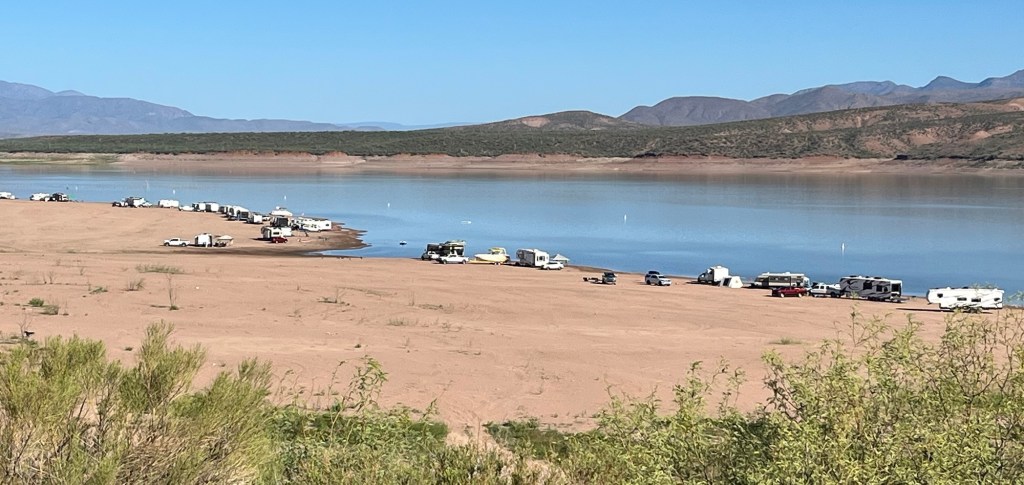
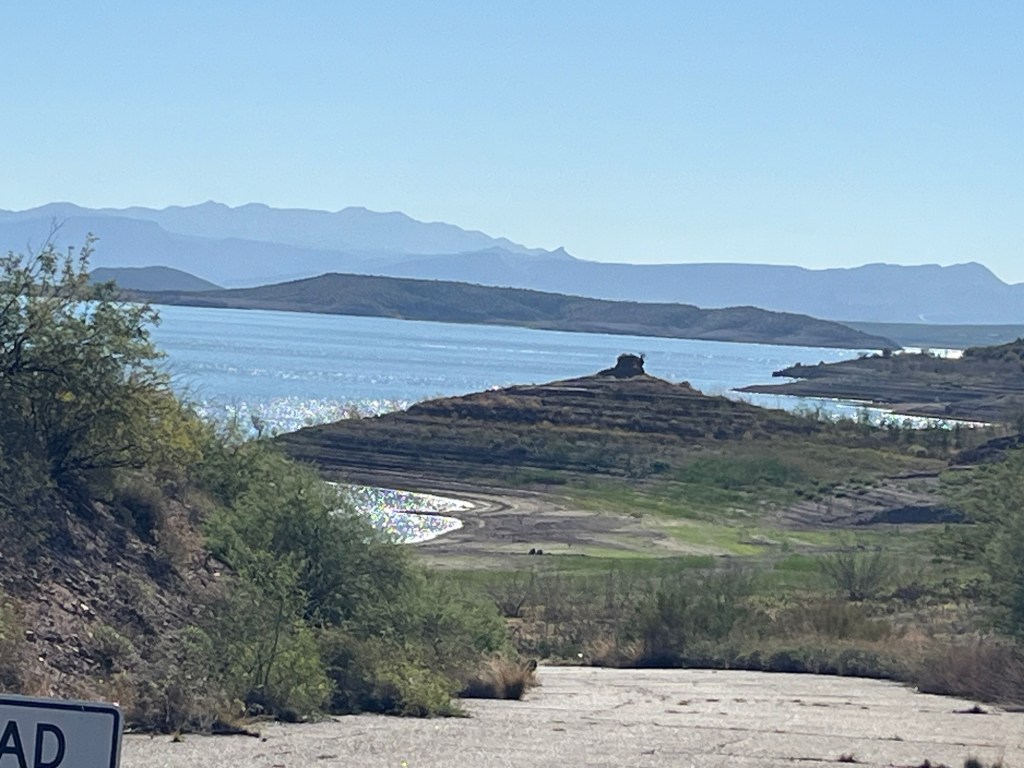
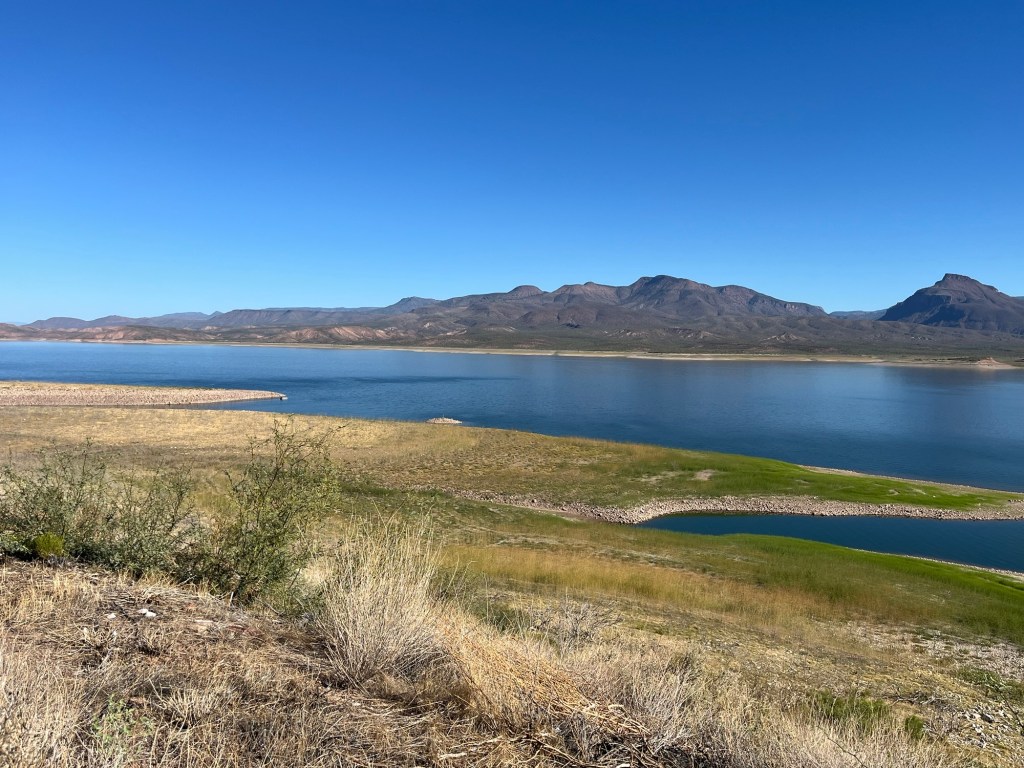
The first 30 miles was a relatively flat ride with many views of Roosevelt Lake and the Tonto National Forest. Roosevelt Lake is a large reservoir over 22 miles long created by the Theodore Roosevelt Dam of the Salt River. It supplies half the water needs of Phoenix’s Valley.
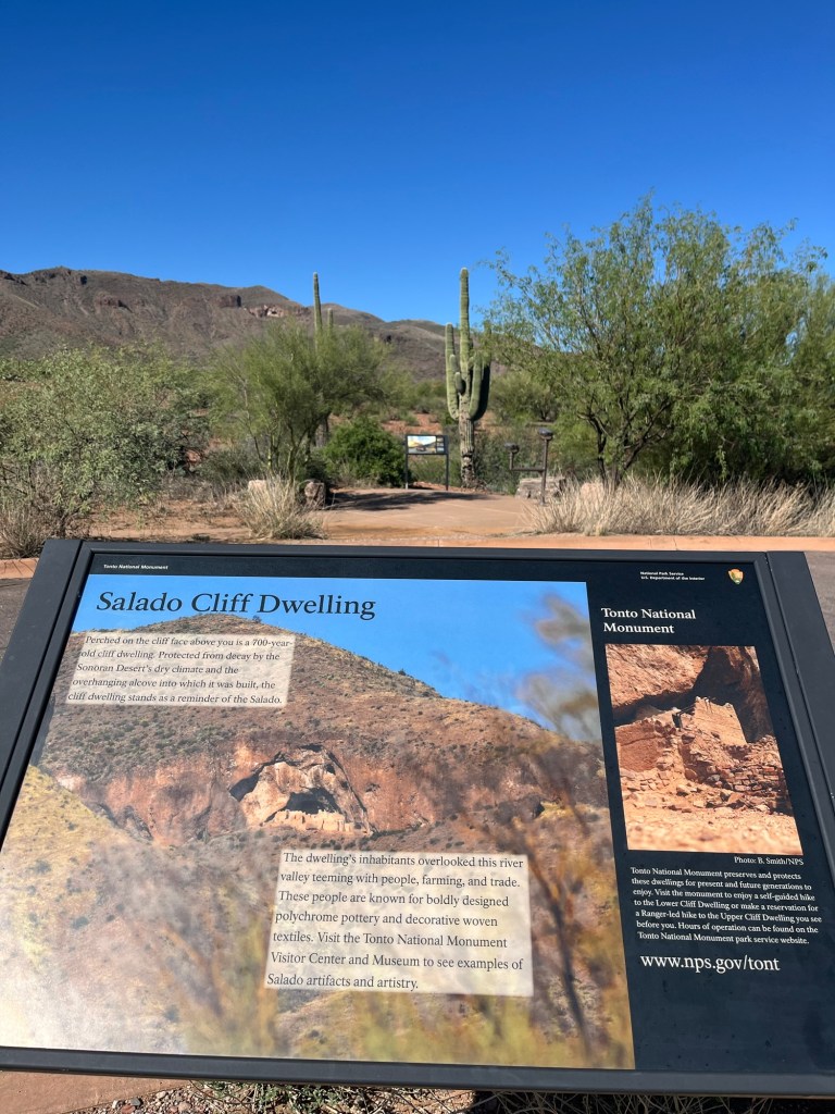
Also in this area are cliff dwellings that I was able to see from a Scenic View area, but the actual road to the monument was closed due to the government shutdown.
After that we did a 6.0 mile climb where we gained 1669 feet of elevation, which is an average grade of 5.1%. It took me about an hour to get up that hill. It was a good challenge and an epic climb for our adventure.
Then we rode to Globe. I couldn’t really enjoy Globe because they had a major flood a week ago and a lot of cleanup was still going on. The historical district was hit hard and some of that area is closed. We had to carefully navigate the construction and traffic.
After Globe, we had an easy ride down to Cutter where there is a campground next to the Apache Gold Casino. We had the option to stay at the casino hotel which I did as a birthday present to myself! I went to the casino after our nightly map meeting and won $200. A lucky night!
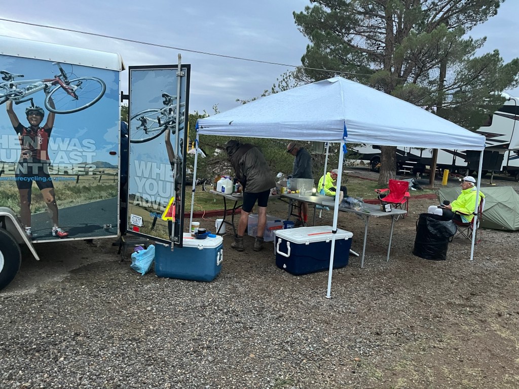
FYI – I read all the comments you make on the blog. I don’t have time to respond individually, but I’ll try to answer requests or questions. My sister-in-law, Sue, wanted to see how we cook at the campgrounds. So I’ve added two pictures below showing the set up.
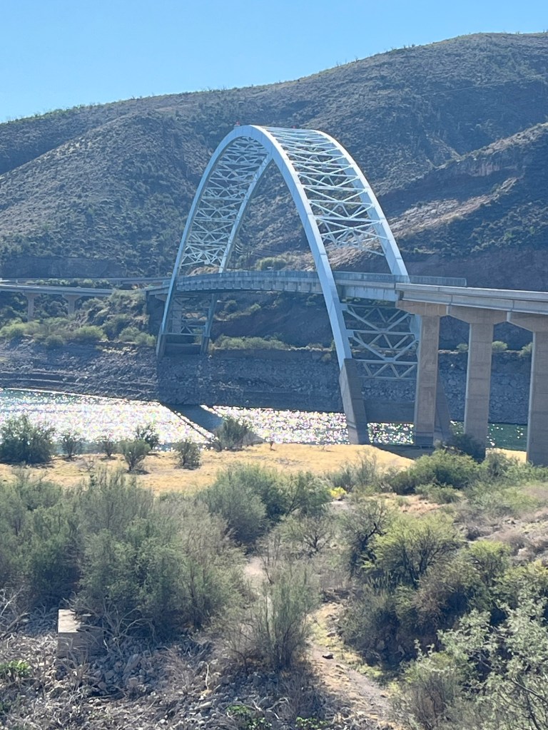
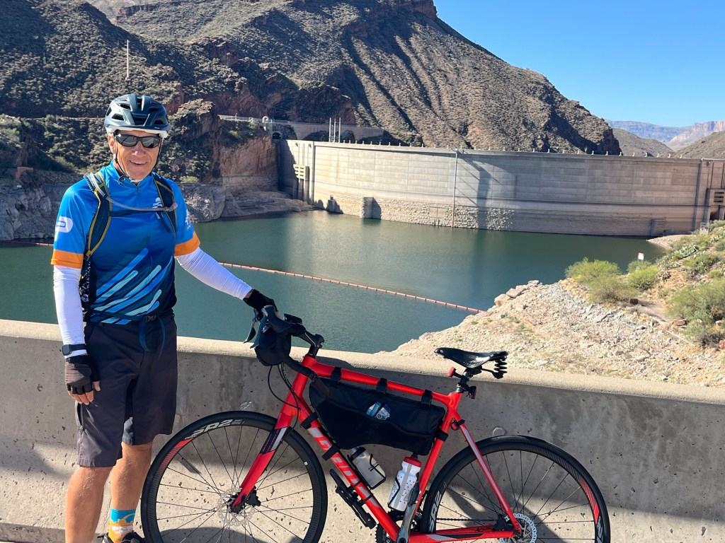
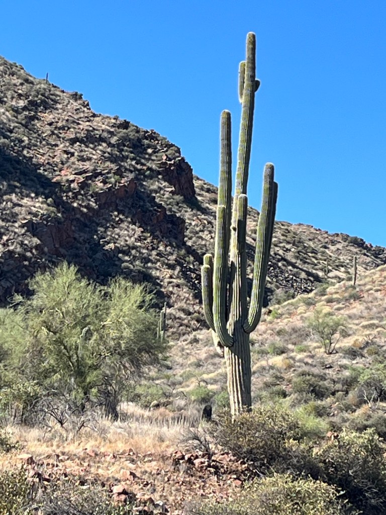
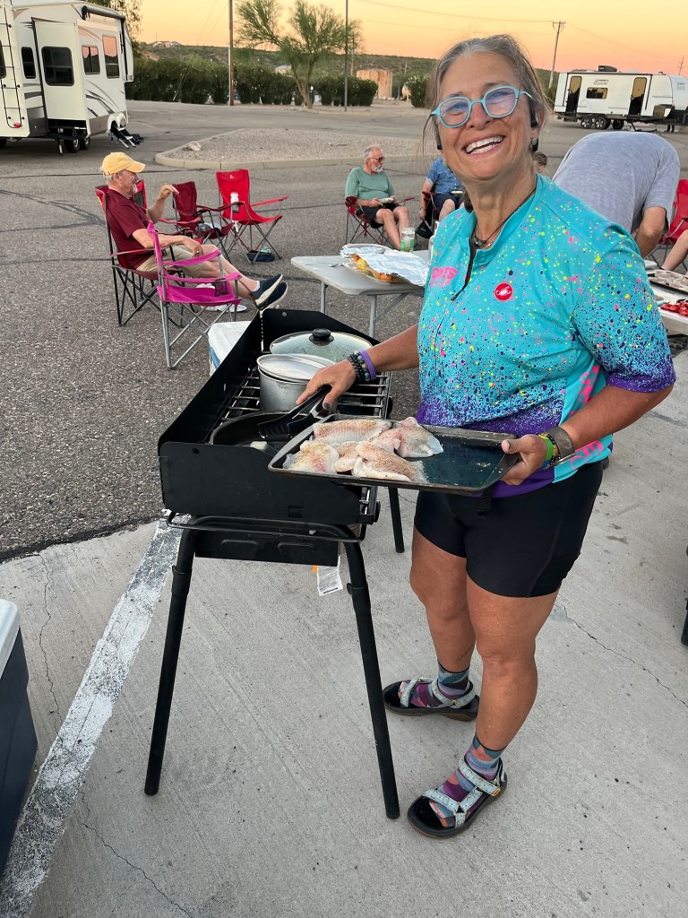
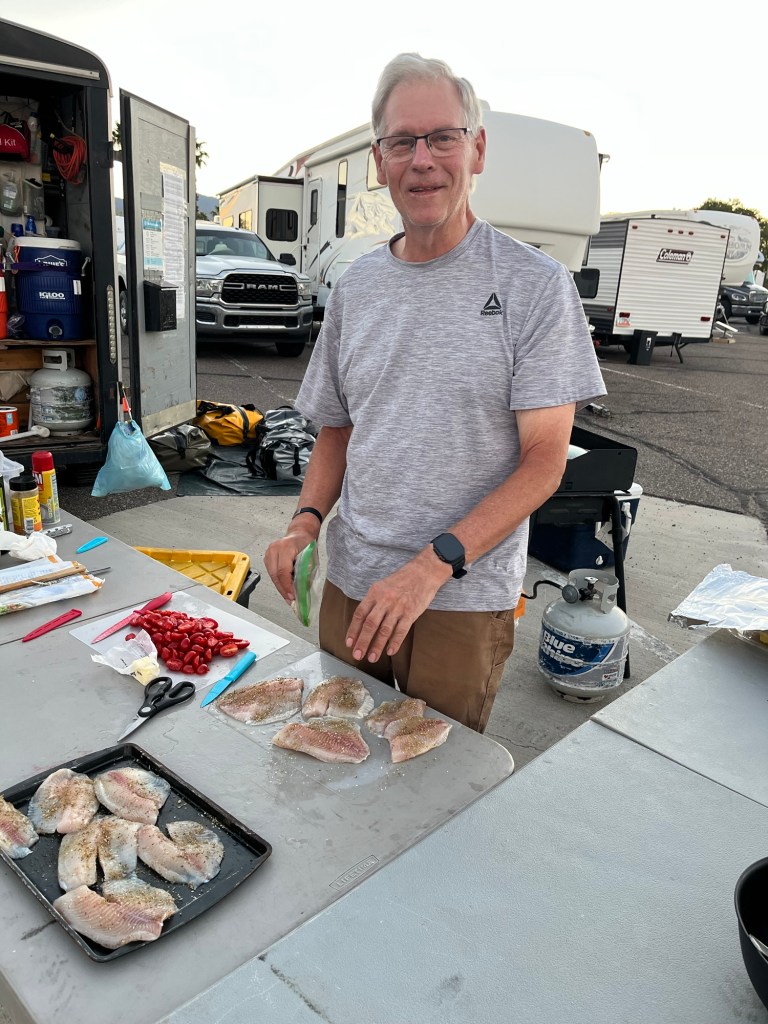
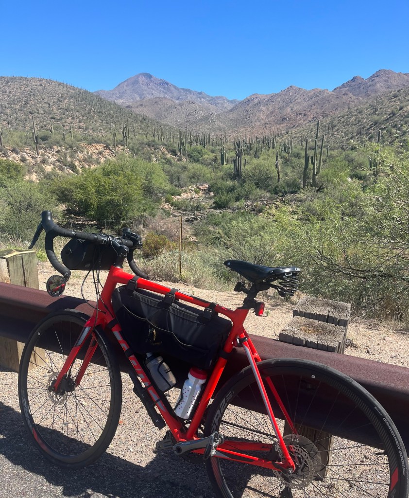
Area of Roosevelt Lake where people are camping. Roosevelt LakeMore Roosevelt LakeBridge over the Salt River at Roosevelt LakeView of the top of the dam from the bridgeRandom Saguaro in Tonto National Forest Cliff dwellings at the Tonto National Monument. Can you find it in the mountain?Yes, we’re going up that road and over the mountain rangeWe made it to the top!Tour leader Tammy at the propane stove with 3 burnersBrent preparing the Tilapia which we had with sautéed veggies, and quinoa and tomato salad.
Today’s ride will possibly be the hardest day of the whole trip. Before we started, the group was given two options. 1. Ride the entire scheduled length from Downtown Phoenix to Tonto Basin, AZ of about 95 miles or 2. Hop on the van with your bike and get transported to a point that eliminated the first 30 miles. Most people wanted to do option 2. However, Dana and I wanted to ride the whole thing, so the two of us started riding from the Phoenix hostel at 6:30 this morning while the rest of the group loaded their bikes on the van. Dana and I liked our Sunday morning ride (with no traffic) that took us on a nice canal path, rode into Tempe past Arizona State, rode into Mesa past Sloan Park, and finally, rode past my favorite house in Mesa (wait for the pictures). This was a very gradual uphill ride past the 202 loop and then we headed north up the Bush Highway and then the Beeline Highway to about 15 miles before Payson where we turned right and made our way to Tonto Basin.
Not only was this a long ride but it was mostly uphill. The elevation gain was 6,328 feet. Yikes!
Today was also my first day with tire problems. At mile 42, my front tire popped a leak. Luckily, the sealant in my tubeless tire stopped the leak. I also put some crazy glue on the leak spot and that seemed to solve the problem. At mile 57, my back tire popped and this time it was questionable whether it would hold. I continued riding until I got to the Adenture Cycling van which was at about mile 68. I pumped up both tires and then ate my lunch (peanut butter and jelly sandwich). The van sometimes parks along the route when there are no gas stations or other places to refill water bottles, which was definitely the case today.
After a quick lunch and rest, I noticed the rear wheel was flat. After help from Pat to try and plug the tire, it did not hold, so I put a tube in it and that seemed to do the trick. So after about an hour at that stop, I was off and riding again and made it to the Punkin Center lodge in Tonto Basin a little after 4:30, more than 10 hours after I started.
I’m glad I chose to ride the entire 95 miles. There was lots to see through Phoenix and the ride up into the mountains was very scenic. A great day overall!
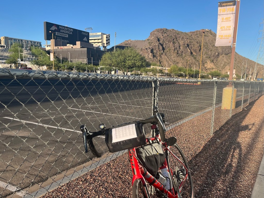
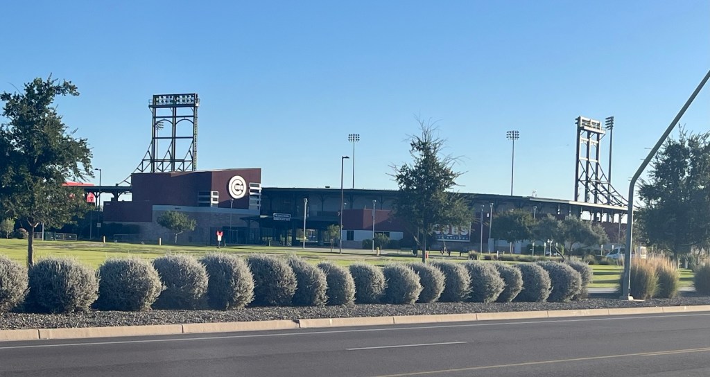
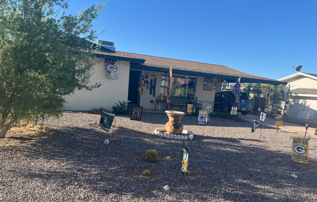
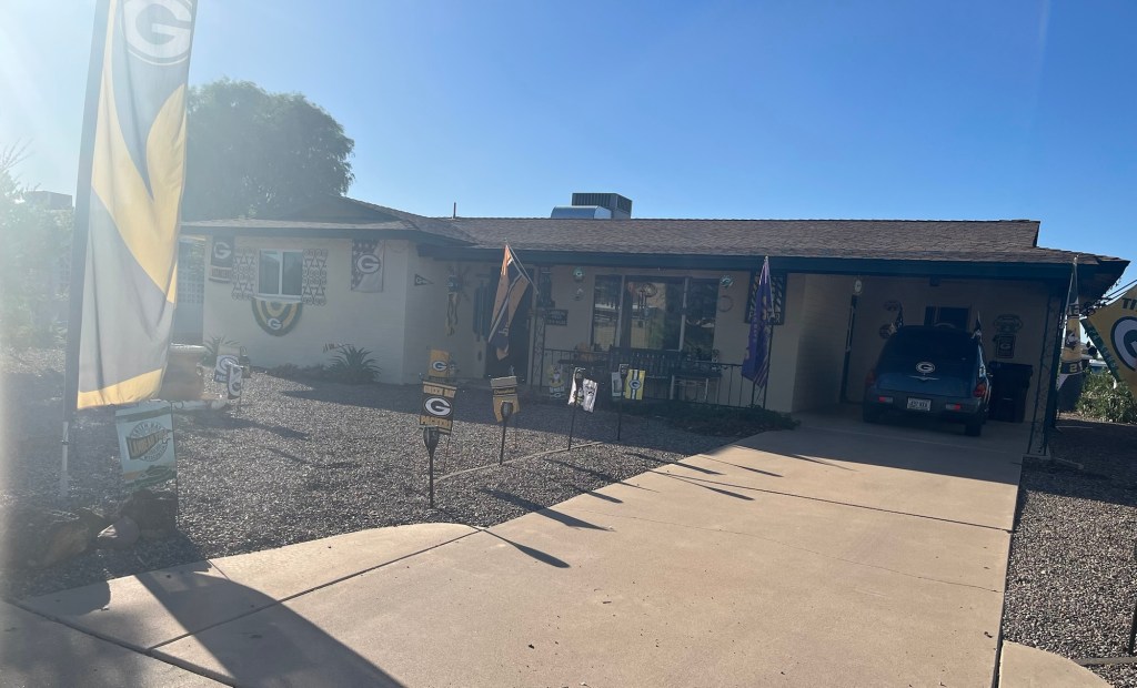
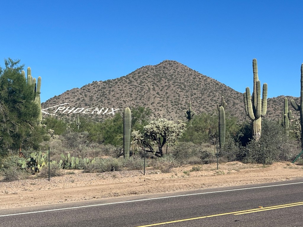
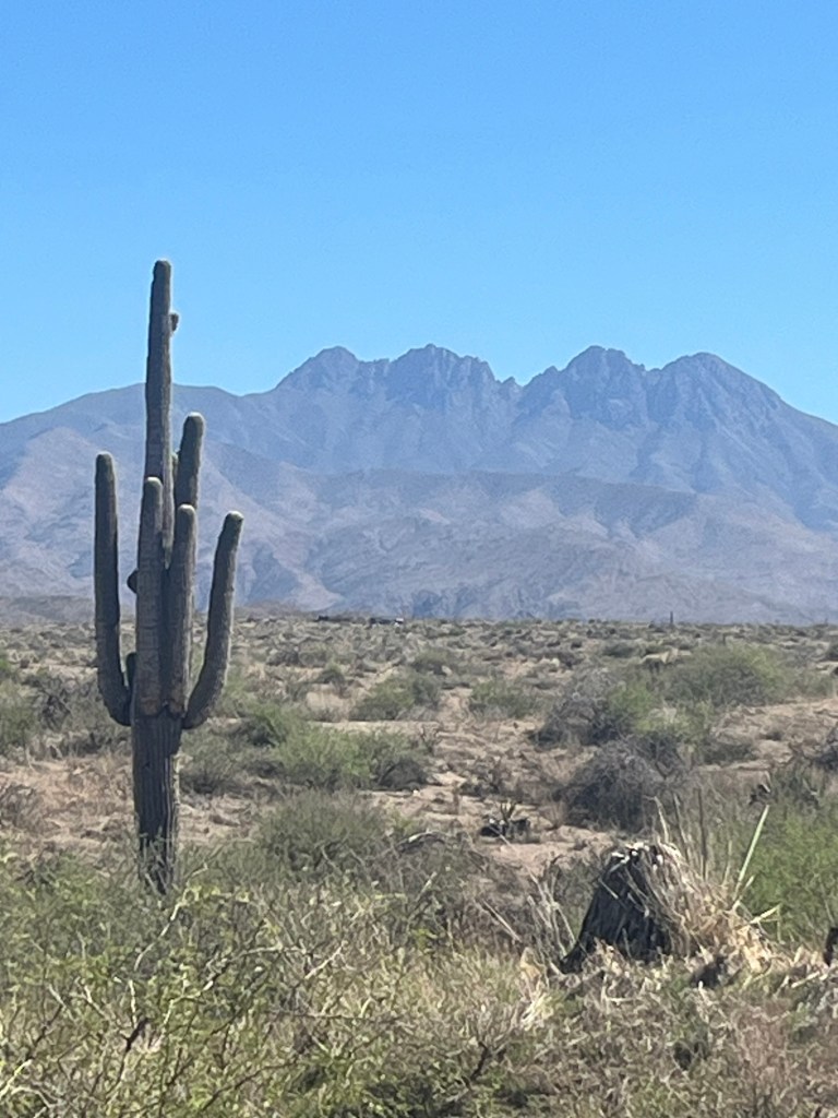
Not a great picture, but this is the Arizona State football stadium on the left and “A” mountain on the right in Tempe. This one’s for Jeff W, it’s part of the State Farm campus in Tempe. Here’s a picture for Karen, Tara, and all you Cubs fans. This is Sloan Park in Mesa, the spring. Training home of the Cubs. (Oh yeah…by the way…Go Brewers!)My favorite home in Mesa! Zoom in to check out the decorations!This one deserved a second picture! Go Pack Go!Goodbye Phoenix!Crossed the Gila River on the way out of Phoenix Note the paddle boarders. In the summer, tubing is popular here. I was able to go tubing with friends in early August here. Thanks Carlene for organizing that fun day. Had a great view of Four Peaks mountain today. I wonder why they call it that?Lots of Saguaros in this canyon. We started the ride at about 1000 feet above sea level in Phoenix and this was the elevation at the highest point of our ride today.